Hi, my name is Isko Salminen.
I'm an adventure seeker and I love exploring nature with my camera and Australian Shepherd called Fire

Filtering by Category: Articles

Day 77: Its time to boogie!

white-rabbit.jpg

Date: July 15, 2017
Miles: 13.8 miles (22.2km), from Sonora Pass to mile 1,030.7. 
Health: Feeling great. 

Now that we are done with the Sierra, it's time to start moving again. From today I have exactly two and a half months until the end of September and when I'd like to be at the Canadian border – the Northern terminus of PCT. Which means I have to do about 1,620 miles (2,607km) in that time. That means some seriously long days. 

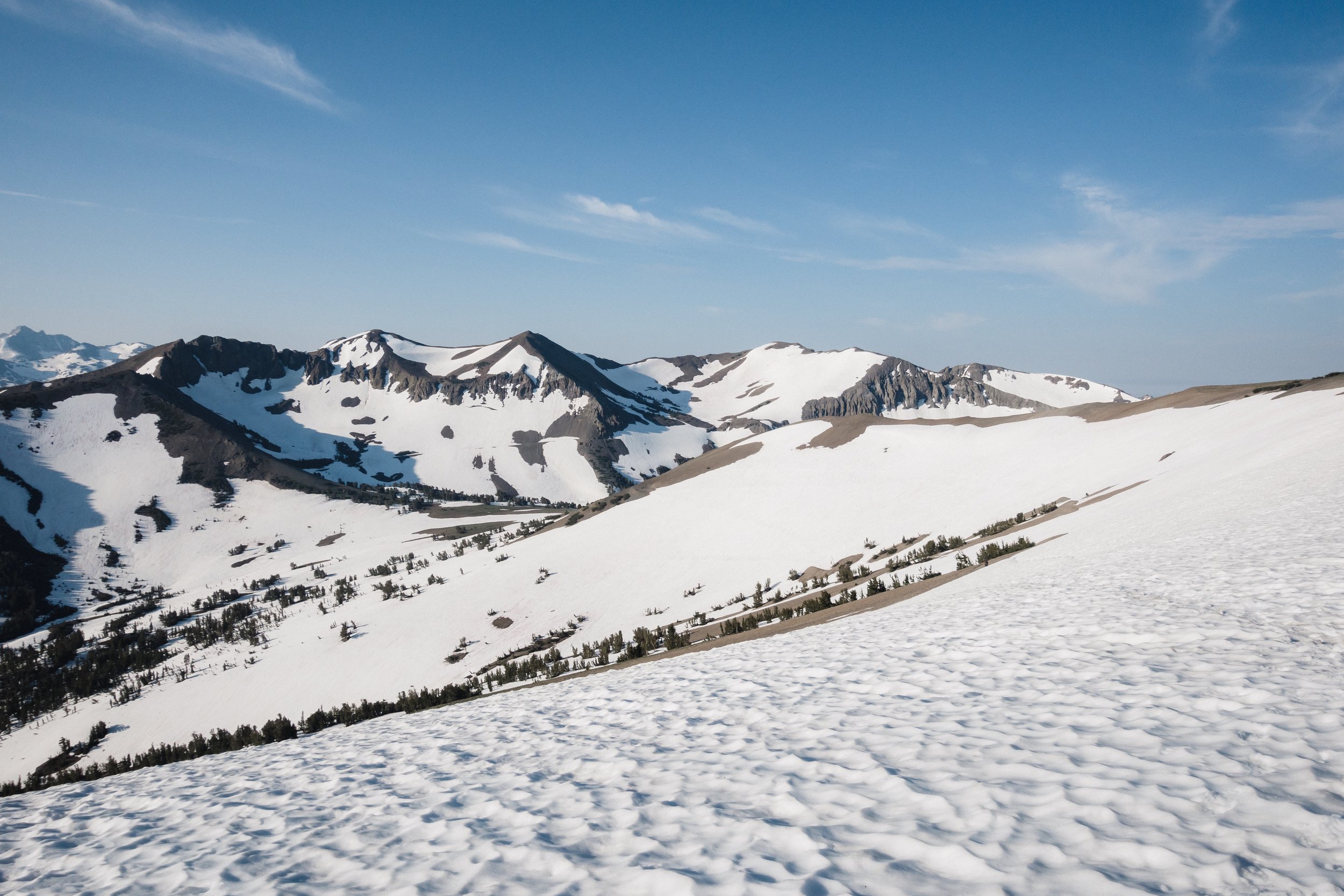
While we're done with the Sierra, it doesn't mean we're done with the mountains and the snow. I feel like it's going to be a really tight run to the border to make it before the winter sets in. 

White Rabbit and Reroute hitching.

I woke up in my hotel room a little later than on the trail, but I was still up before 7 am. Why do I have to wake up so early when I could sleep late? I try to use the shared bathrooms but they are all occupied so I go back to my room. I go through my food and make a list of things to buy. I also start packing my pack. While I really liked the MLD Prophet, I love the Pa'lante Packs Simple Pack. 

I try to use the bathrooms again but no luck so I head down for the breakfast. It's nice to eat breakfast inside, by the table, without any hurry. And freshly squeezed orange juice. Yummy!

Sonora Pass.

After the breakfast, I go back up to the room and finally one of the bathrooms is available. After a quick shower, I head out to get the groceries for the resupply and to get more bug spray. On the way, I run into Airplane Mode. She's going to get breakfast and as I wonder why she didn't eat the breakfast included in her room, she notices that she completely forgot that. 

I get the bug spray from the sporting goods store and try to resupply from the General Store but the options are very limited. Unless you're looking to eat a lot of canned goods. After a lot of back and forth, I manage to scramble something together. Luckily it's only four days in South Lake Tahoe. 

Sonora Pass – looking towards Bridgeport.

I cross the street back to my hotel and go finish with my packing. Everything fits easily inside the 32 liter pack. I'm excited to get back out without the bear can and microspikes. Even though I still have the ice axe my pack is so much lighter.

After checking out from the hostel I head to the Jolly Kone for one more taco salad before heading out. I'm still full from the breakfast so I only manage to eat about half. White Rabbit and Reroute join me and we start hitching out of town together. 

Climbing up from Sonora Pass.

We walk to the end of the Main Street, put our packs down and stick our thumbs up. It's hot in the sun and none of the cars stop. To make the time go by faster we make a game of hitching. We each get ten cars to try to get a ride and the first one to succeed wins. We try our best moves – I lift up my short sleeves to show a little leg, Reroute tries dancing, and White Rabbit goes for the good old looking happy. But to no avail. 

White Rabbit tries to yogi a ride from the gas station across the street but again nothing. We notice a large white cardboard close to us and think about writing on it, but as none of has markers, we skip that plan. I go get the sign and suggest that if we just hold the empty sign, maybe people will stop to just ask what our sign says, or why it's empty. It’s as good of a plan as any, as it seems we're not getting a ride anytime soon. I get the sign, get to the side of the road, lift up the sign, and literally, the first car stops to pick us up. Epic!

Looking back towards Sierra.

Our savior can only give us a ride to the Sonora Pass junction as he's continuing to Tahoe. We happily accept as it takes us a lot closer to the pass. Once at the junction it's time to stick out our thumbs again. After about 15 minutes we're picked up again and make it all the way up to the pass. 

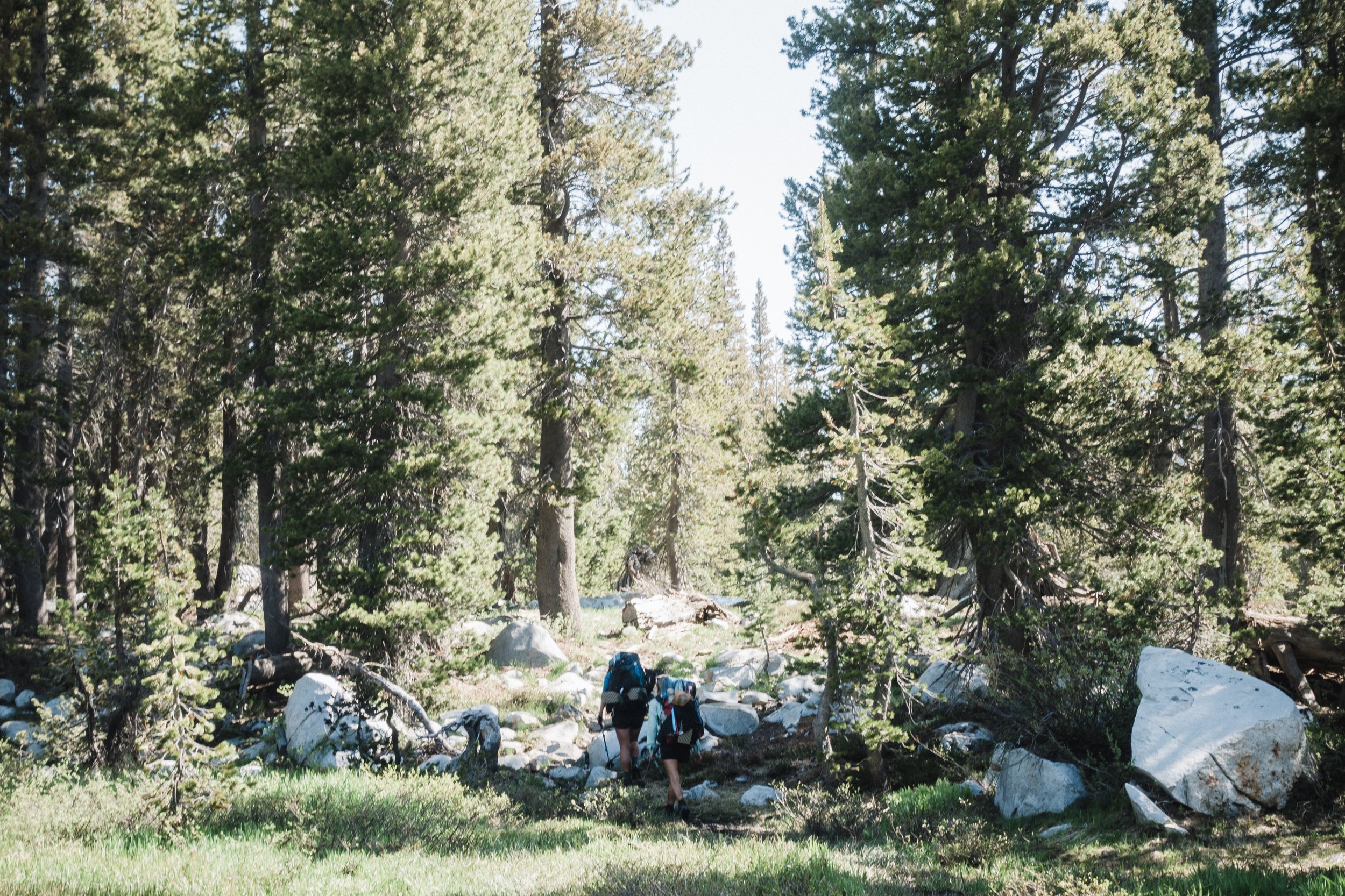
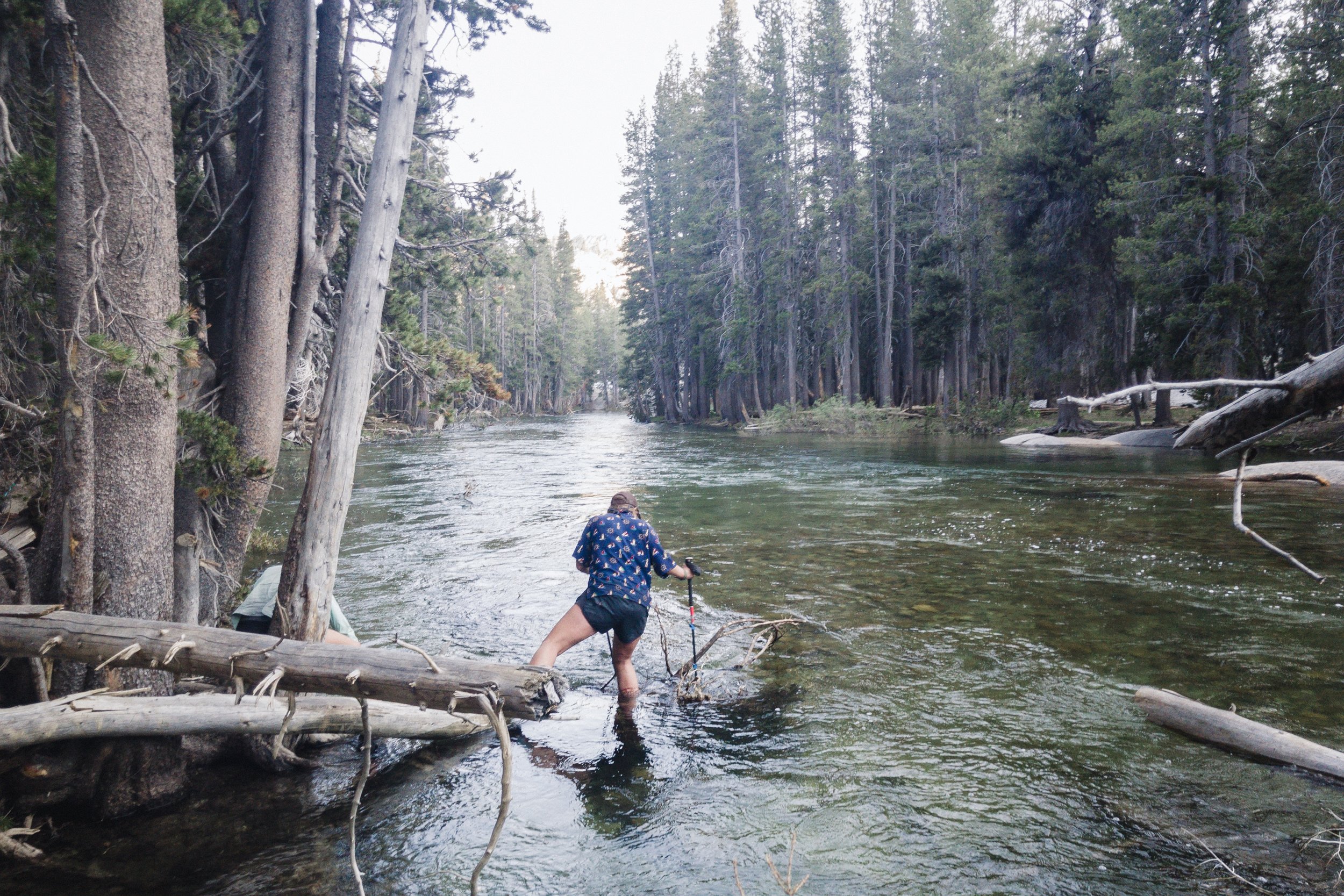
On the way to the trail, we run into James who's getting his resupply package deliver here. We chat for a while and then head out. The trail climbs instantly and we spend the next hour climbing. There's some snow on the trail and few of the stream crossing on top of the snow are a bit sketchy and I fall through on a couple of them. 

Looking down towards Sonora Pass (see the trail in the center).

On one part the trail is washed away and under a vertical snow wall. I decide to climb upwards to drop down from there, while White Rabbit and Reroute decide to take the lower path. As I’m dropping down the steep snow and sand face, the rocks beneath my feet slip off and I lose my footing and tumble down towards the deep canyon beneath the trail. I manage to grab a couple of bigger rocks and gain my balance long enough to stop my slide. This was stupid! Luckily I got out of that with just a few scrapes and a bruised ego.

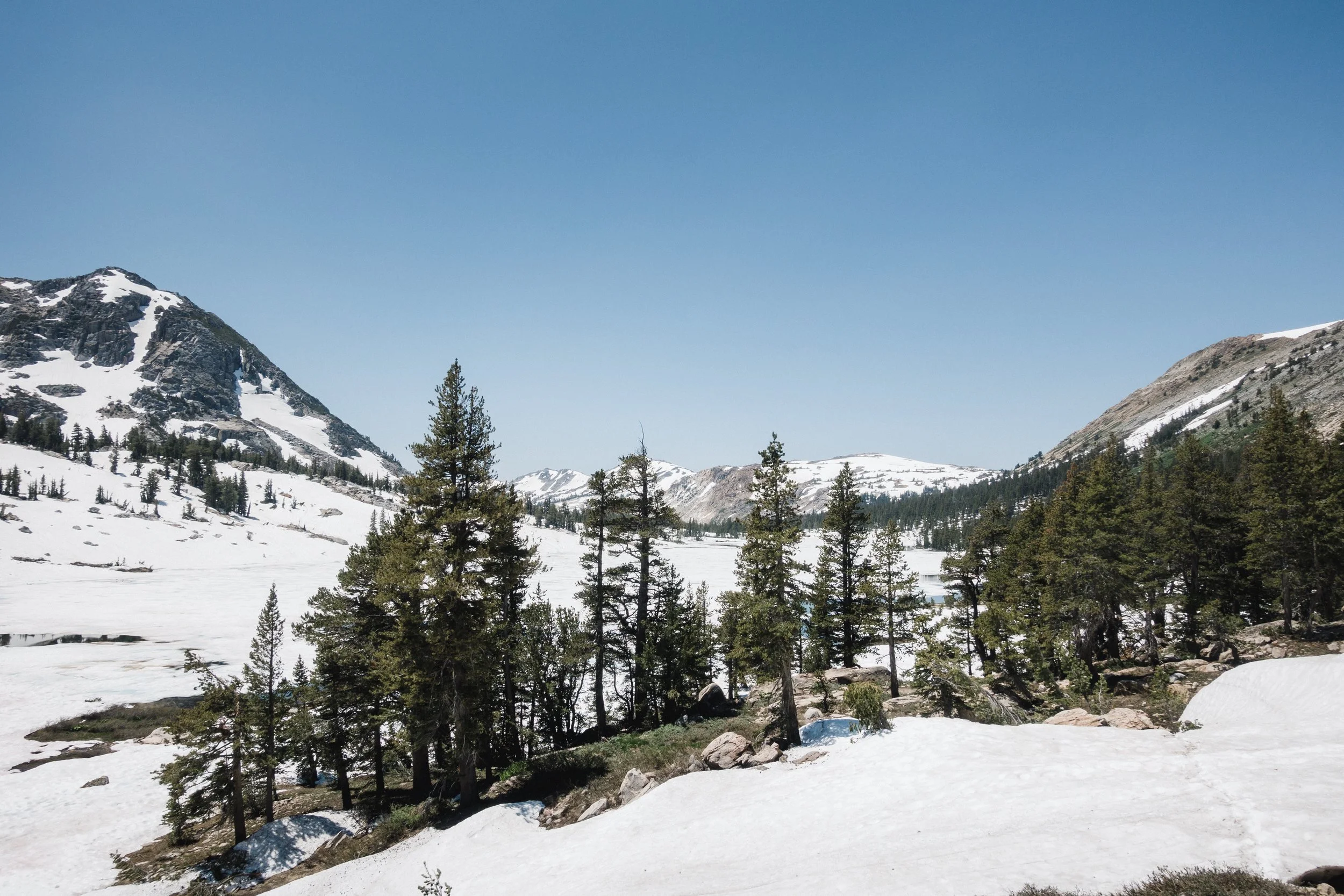
After climbing the southern facing side we get on the northern side and we’re back on snow.  As it’s already late in the day so we slip and slide on the slushy snow. I travel faster in snow and soon White Rabbit and Reroute are so far behind that I don’t see them anymore. I boot ski down the slope, towards the valley where I think the trail leads to. I can’t see the trail but there’s really no other way the trail could go. 

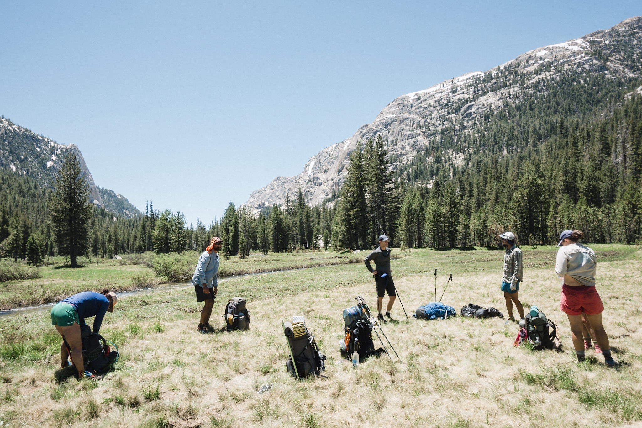
Right before I reach the end of the snow I stumble upon the Jew Crew having a break on a snowless patch of grass. As I haven’t seen them for a while I stop over for a short chat and we head out the same time. They keep asking me all these questions about snow and hiking in it. It’s funny how granted I’ve taken the snow hiking skills. 

My Mountain Laurel Designs Patrol Duo Shelter with Serenity Duo bugnet.

I soon leave the guys behind too and reach the dry trail. I pass couple obvious camp spots as I want to still get more miles in. Finally, I reach a small stream and it’s getting dark. I don’t see anyone around but a quick glance at Guthooks tells me there aren’t any other spots to camp ahead so I stop here. 

My Pa'lante Simple Pack with the ice axe.

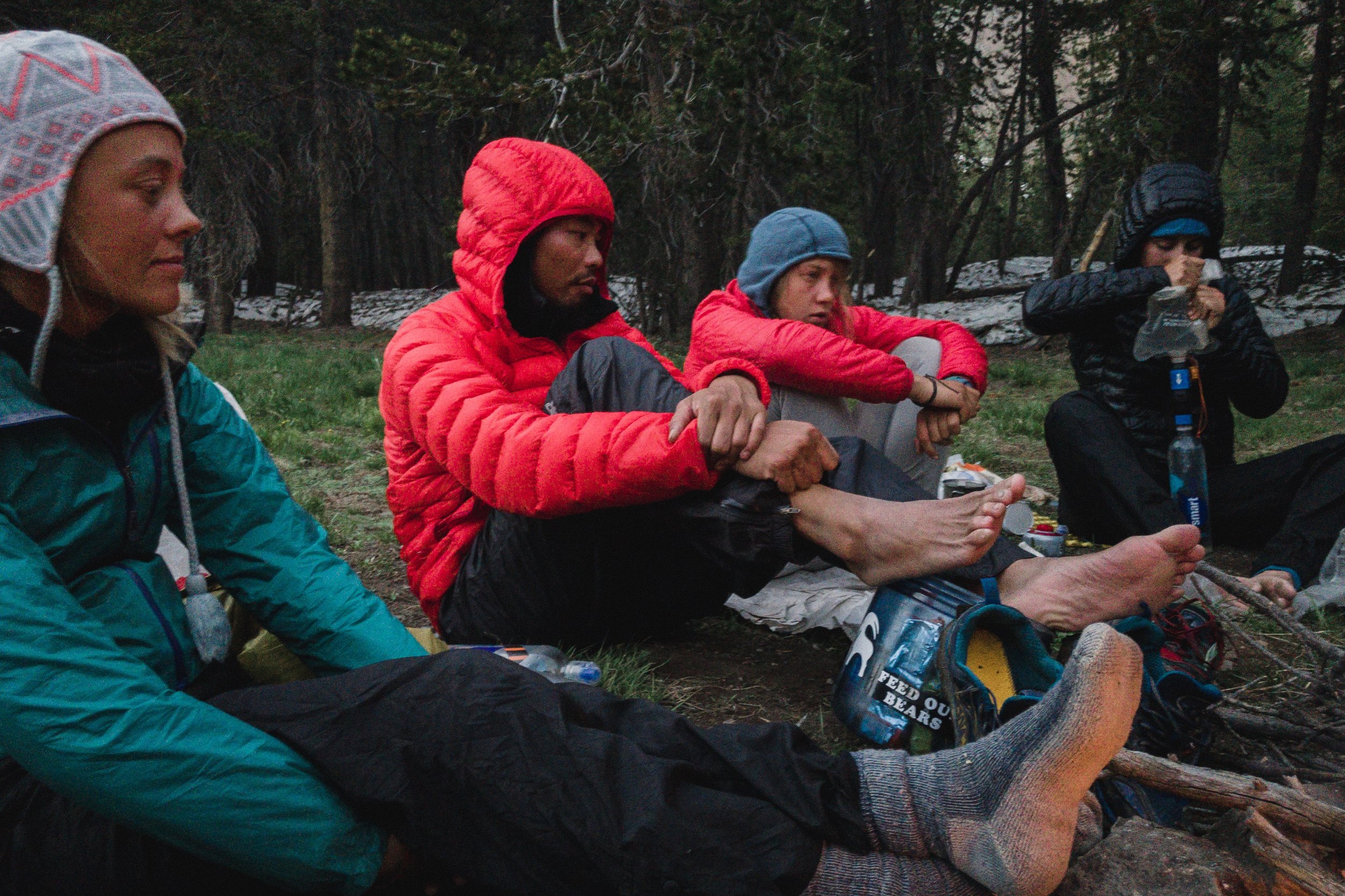
I set up my camp, filter water from the stream, and make my dinner. I keep my eye on the trail hoping to see either the Jew Crew or White Rabbit and Reroute. Just as I’m about to call it a night the Jew Crew comes up. 

We sit on the rocks next to my shelter and talk as they quickly start making their dinner. We end up talking late into the night eating some of their resupply as they had sent too much food. Who can say no to sugar covered donuts after a day of hiking? As it gets dark we call it a night and I fall asleep listening to the soothing sound of the stream next to my shelter. 

Day 76: Sonora Pass, end of Sierra, and Footloose’s last day on trail

IMG_2215.JPG

Date: July 14, 2017
Miles: 11 miles (17.7km), from mile 1,005.9 to Sonora Pass.
Health: Feeling great. Thanks to the later start I got more sleep last night.

Today we have a short 11 mile hike to Sonora Pass which marks the end of Sierra, and it means we don't have to carry the bear canister anymore. From Sonora Pass, you can either hitch to Kennedy Meadows North or Bridgeport. I’ve shipped my Pa’lante Pack to Bridgeport so that’s where I’m heading. 

As today is Friday, and the Post Office is closed for the weekend, I need to get to town early so that I can first get my new pack and then sort out my gear to see what I want to send home with my bear can and what to keep. I’m so happy to get rid of the heavy canister, but I’m also wondering if I should get rid of all the other Sierra gear. We keep hearing that there are still some sections from here to Tahoe where people have needed ice axes and microspikes. 

My bear can. I'm so happy to get rid of this thing!

My bear can. I'm so happy to get rid of this thing!

We wake up later than usual, which feels nice as we get to sleep longer, and then quickly get on the trail. Knowing today is a town day makes waking up and getting back on trail a lot easier. 

I’ve forgotten to filter water last night so I have to drop down back to the stream as the others head out. Most of the trail we’ll hike today follows along the top of the mountain range so there’s no water available. After filling my bottles I head after the others. 

IMG_2218.JPG

The trail is covered in snow but it’s easy to follow. I soon reach the water crossing for the small creek I got my water from earlier and cross it using a snow bridge. From here the trail is dry and I reach the switchbacks that climb up to the top of the ridgeline. 

Climbing off-trail.

Climbing off-trail.

As I’m approaching the junction I hear the girls yelling my name from somewhere behind me. I try to yell back but feel like they can’t hear me. I run back towards the sound to find the others back on the other side of the stream, climbing up the steep mountainside. They signal me to get there as well. I look up and the path they’ve chosen doesn’t look good. It’s steep and covered in scree. I’d much rather follow along the trail as it looks much easier. But everyone keeps motioning me to come over and I can't hear what they're saying because of the sound of the water.

I start thinking there’s something that I don’t know, like maybe the trail is broken ahead and we need to go around, so I cross over and join the others. Once on the other side, I hear that we’re just trying to cut trail miles by going up the steep mountainside. I open up the map again and do some quick math – we’re cutting 0,7 miles. This doesn’t make any sense?

Still ways to go to reach the top.

Still ways to go to reach the top.

I climb up with the others and it takes me an hour and twenty minutes to get to the top and back on the trail. So to cut 0,7 miles, or about 15-20 minutes of hiking, I just wasted over an hour. As I’m already in a hurry to make it to town before the Post Office closes I’m not happy about wasting all that time and start speeding towards the Sonora Pass while others are still climbing up the steep scree slope.

From here on, the trail follows along a beautiful ridgeline, but I can’t really enjoy the scenery as I have to make up the lost time. Soon I reach the part where I can see the road down in the Pass, I’m not far. I know that there’s an epic glissade down from the Pass but as I reach the top, I can’t see around the edge of the slope. Not being able to see what lays ahead, I don’t really want to try my luck. So I decide to follow the trail and hike down.

IMG_2216.JPG

Soon the trail switches back to the slope and I can see the slope I would’ve glissaded down and it’s steep! I’m happy I didn’t go at it alone. But now the trail is covered in snow and the only way down is in the snow. There’s an established glissading path so I traverse up to it and glissade a good way down. Having nothing but thin shorts on makes for an interesting feeling on your buttocks. I hobble on with a smile and stinging, cold feeling on my buttocks. Little longer and I'm pretty sure I would've gotten snow burned.

Looking towards Northern California.

Looking towards Northern California.

Eventually, I get all the way down to the Pass and find a setup of tables, chairs, breakfast cereal, and beverages there. A trail angel has been in the Pass providing breakfast for all the hungry hikers coming down from the Pass. There are only two hikers there as Chipmunk, the trail angel, is giving other hikers a ride down to town. From the Pass, you can either go down to Kennedy Meadows North, or the other way to Bridgeport. As receiving packages in Kennedy Meadows North costs money, I’ve sent my package to Bridgeport.

Crossing the range and getting to the pass.

Crossing the range and getting to the pass.

I drink two glasses of orange juice and then hop on the road to hitch to town. As soon as I stick my thumb up, a pickup climbs up the steep road and stops. The nice couple in the car offers to drive me down to the junction to Bridgeport. Getting even halfway to town sounds good and I hop on board.

As we drive down the winding road we talk about the PCT and I tell them all the general things about the trail. Soon I notice we’ve passed the junction they were supposed to leave me at. As I ask about this they just smile and say they can easily give an hour of their time to get me to town faster. The kindness of complete strangers out here never ceases to amaze me!

There's the road!

There's the road!

Thanks to getting a ride all the way to town I make it to the Post Office in time and get my package with my Pa’lante Pack inside. As I need to explode my entire pack and decide what I still need and don’t need, I’ll get the cheapest motel room I can find and spread all my gear on the floor. I go through everything and sort them into two piles: things I still need, and things I can get rid of.

I’m sending home some of my warm gear, the bear canister, microspikes, and some other small stuff. I’m still keeping my ice axe as we’ve heard rumors about deep snow all the way up to Tahoe. I take all the gear I don’t need anymore and stuff it into the bear canister, close it, and run back to the Post Office. Weighting the bear can in my hand I’m super happy to get rid of all this weight. After shipping the gear to San Diego, I go back to the hostel to take a shower, do some laundry, do an inventory of my food and what I need to buy, and work on the blog for the rest of night.

I can’t believe we’re done with the Sierra! It was physically challenging, hard on the body, and some of the most epic hiking I’ve ever done. Looking back we were so lucky! We timed our Sierra entry perfectly, the weather was absolutely stunning the whole time and the heat wave that hit us right before Kennedy Meadows South melted the snow just enough to make getting through easier for us. A week earlier, or few weeks later, and it would’ve been completely different beast. 

The only grocery store in Bridgeport.

The only grocery store in Bridgeport.

I’m happy to start Northern California, which, as I’ve heard, is a different kind of a challenge. Where the desert and Sierra were more of a physical challenge, NorCal is going to be a mental one. That’s where most people end up quitting. That's going to be hard for me as I can take the physical beating for ages, but I’m not good with boring, mentally challenging tasks. There are still over 600 miles to the California – Oregon border, and it’s going to be hot, dusty, and boring. This is the section I’m worried the most! I just need to put my head down, grind the miles, and pray that my head and motivation can make it to Oregon.

Footloose’s notes about his experience with us

Airplane Mode, Blis, Footloose, LL, Happy Feet, and Indigo.

Sonora Pass is also where Footloose, Indigo's dad, ends his hike with us. A few days ago I asked if he’d like to write a short text about his experiences on the trail with us and he happily agreed. I felt it would be interesting to hear the perspective of someone who joined us mid-hike, with fresh legs, hiked through the Tuolumne meat grinder, and had to keep up with a group of trail hardened thru-hikers.

Here’s what he had to say:

I had idealistic visions of joining my daughter one month into her PCT journey. Beauty, bonding, and nature were all that was on my mind. As I’m in good “gym” condition, I was just worried about the logistics of meeting up with her due to minimal cell connection and unpredictable trail times. 

I met Indigo's trail family (her trail name is Koala...hugs) after 400 miles of driving, 4 hitches and a bus trip, little did I know that was going to be the easy part. It started off gently enough with an 8 mile hike late in the afternoon. The next morning hell hit in full force. Due to the need to arrive at the post office before the weekend closure, I learned that we’d be shortening the 5.5 day trip into 3 full and 2 half days, averaging 18 miles a day on the trail tenderly known as the “meat-grinder,” which half the PCT trekkers were skipping this year due to snow and water levels. 

Traversing icy snowfield above a raging river.

That day the truth hit, PCT hikers are not just outdoor enthusiasts and adventurers, they are warriors, and I was completely out of my league. They are hardened mentally and physically by the pounding on the trail. They have hiked with hunger, thirst, bloody feet, sprains, broken bones, lacerations, illness and constant stiffness. They have blistered through layers of skin to grow thick calluses, their bodies have adapted to elevation with increased vascularity and blood supply and they have gained animal-like senses of the terrain and trail tracking.

Over the five days, between my fatigue, awe, and bonding with the group, I noticed some unique dynamics among the PCT population.

FAMILY: While each hiker is capable and independent, the formation of families is important for survival in the Sierra. Each hiker naturally assumes familial roles to allow the group to function. In the HERPES family (an acronym of honorable traits, and... it never goes away) Isko was Dad; Airplane Mode- Mom; Bliss- Big brother; Koala and LL Cool Jay- twin sisters; and Happy Feet- wise, quiet brother. Each voice equally important, requiring constant communication, confrontation, honesty, vulnerability, leadership, and consensus… and of course natural family drama.

Crossing one of the many rivers over a log.

HUMOR: I have never been around a funnier group of people. I think it is the drug that keeps them going. Jokes and punch lines were strung together like Christmas ornaments, every member seamlessly adding a deeper dimension and texture, never missing a beat, allowing the joke to morph into something new and then unexpectedly coming full circle until it could rest in perfection.

POSITIVITY: Each morning and night I heard personal mantras about “loving to wake early”, “looking forward to the cold and soreness” and the gifts of all the hard things.

BEAUTY: A persistent awe and unwavering appreciation for nature.

MAGIC: At Sonora Pass (76 miles), Chipmunk brought tears to several of our eyes. He had a spread of fruits, drinks, and vittles hot of the griddle for the hikers. For 7 years, 3 times a month, he has driven 200-300 miles to grace PCT hikers with his trail magic.

FUN: With no commercial entertainment, creativity flourishes. Sing-alongs, dance sessions, glissading competitions, parades, freestyle rapping. Endless fun.

Climbing a snowy pass.

I seriously did not think I could make it the second day, but when my plea bargain for suicide brought no compromise, I took the lead from the night's mantras and accepted that I could make it one step and then another. Walking meditation on the tough parts saved me and DEET provided salvation from the mosquito swarms.

On day three I earned my PCT name, “Footloose” in affection for my commitment to remove my boots at every river crossing and my love of dancing. (In my defense, my waterproof boots kept water in as well as it kept water out, so I rationalized that 50 shoe changes were better than 50 blisters).

On day four, I had a brief feeling of mastery of the trail then within an hour I had a crippling calf muscle cramp. The cramp didn’t go away, but I learned that I could master my body by hiking through the pain.

On the last day, I have to admit that I was really, really glad to be finishing. Even while I had a creeping sense of regret for all the trail hardening I would be wasting, my thoughts were monopolized by ideations of massage and a hot tub once home. Still, saying goodbye brought me to tears, as I hadn’t realized how over the week I had become a part of the family.

The PCT is not a vacation, it is a kick-ass, exhausting, deeply challenging beautiful voyage that is not well served by expectations. My deepest respect for all the brothers and sisters on the trail.

-Jack “Footloose” Catton

Thank you Footloose for being part of our adventure! Not many people could have done what you did with us!

Day 75: To be the man who walked a thousand miles

IMG_2144.JPG

Date: July 13, 2017
Miles: 18.5 miles (29.8km), from Wide Creek to mile 1,005.9.
Health: Feeling great. Knee bothers a little but it's getting better.

Getting to sleep until 5:15am felt so good, it was like a luxury. Getting up from my sleeping bag and knowing that I would have to jump into an ice cold river in few minutes felt like less of an luxury. I tried to listen to the sound of the river in hopes of hearing less water going through, but to no luck. It sounded just as forceful as it did last night.

I got out and went down to the river to see if the water level had decreased during the night and it looked like it had dropped maybe a feet (30cm) which might not sound like much, but it also looked like the current wasn't as strong as it was last night.

I got back up to the camp and packed everything in my pack watertight and made sure all my electronics were double protected. Blis divided us to two five person groups with him leading the other, and me the other. We did few practice runs of i-formation on dry land and went through all the different calls needed to move as a single unit. 

It was time to get into the water. We all moved down to the river and Blis and I looked at the river and the current. I asked which team should go first and Blis pulled out his hand in rock-paper-scissors style. I lost on the second go so we were the first ones to go in.

I felt good about everything else except the landing on the other side. The creek was so wide that I couldn’t see how deep it was, and if we would even be able to climb up from the spot we’ve chosen. But we were the first to go over so we would soon see.

I told everyone that I'd steer us towards the small rock on the other side and then starting from the back people would climb on it, and I'd then lower myself down stream to get on it too. As a line, we were so long that I’d have to position myself way above the landing site for others to get on it.

I was wearing my rain gear as I knew I'd spend the most time in the stream, first waiting for others to get behind me, and then for them to climb out of the water. I jumped in and took my position waiting for others to get behind me. The current was strong but nothing too bad. As soon as everyone was in position we started moving. Midstream the water got so deep that my hands and poles were under the water and the water went up my sleeves and up to my chest. Sure wakes you up!

IMG_2156.JPG

As we reached the position I was aiming for, the water before the small rock was so deep, and the current so strong, that people couldn't get up on the rock. Plan B. I moved us up towards the larger rock. I didn't want to go there first as the rock face was so steep it looked really hard to climb up on to.

As we got to the second rock the current got stronger and people behind had no change to climb the rock face from such a deep water. Jack, or Foot Loose, gave me a push and I used my poles to push myself up on the rock. This meant that I wasn’t in the front with poles, taking the current for the others, so we had to get everyone out quickly. I pulled Jack up, and then we pulled everyone quickly up.

We were all cold and shivering but we needed to stay here and help the other team up. Blis had watched what we did so he could avoid the mistakes we made. They got into the water and made their way over the stream and we pulled them up starting from behind. Lastly we pulled Blis up. Now everyone was over and we had crossed the Wide Creek.

Morning views.

Morning views.

As everyone was completely soaked and cold, we needed to get moving immediately. We just got on the trail and started walking as fast as we could. It took me a good hour and a half to dry up.

Finally the sun came up and we found a nice little rock spot were we stopped to remove our wet gear and dry off a little. It didn't take long for everyone to arrive. Everyone was in high spirits as the river crossings had been kind of daunting.

Trail goes here.

Trail goes here.

Today looked pretty easy on the elevation map, not much climbing and relatively "flat" sections. But like on previous days, the miles were hard to come by. We, again, climbed snowbanks, hopped streams, and navigated the ever disappearing trail. All this takes so much time and energy, and makes the progress so slow.

My shoes have been constantly wet. When ever they happen to have a moment to dry, there's a new stream or something muddy that we need to jump into and they're completely soaked again. Or if it’s not the water, then it's just the snow melting on them.  I've already gotten so used to putting wet socks and shoes on in the morning that I don't even notice it anymore.

LL.

LL.

At one point I leapfrogged with Cannonball for a while and as we both got frustrated with the snowy forest, we just hiked together. It was fun to hike with her again as it's been almost a month since we hiked together the last time.

IMG_2147.JPG

It's funny how we spend a month hiking with all these people through the desert. You meet a lot of cool people and you kind of take it for granted that you're going to meet them at the next water source or town. You get to know them and think you're going to hike with them all the way to Canada. And then bam, Sierra comes along and our trail family breaks up and our whole bubble disappears. All these people suddenly disappear from around you and for most of them you didn't even have a change to say goodbye.

IMG_2151.JPG

Most people either got off trail, or skipped somewhere north over Sierra, or flipped and are now coming south. I really miss so many of the awesome people we hiked together at the desert. I'm hoping to catch up to them, but it seems kind of impossible as they're almost 500 miles ahead.

IMG_2155.JPG

After covering couple more snowfields and climbing a little, we meet Storyteller who has been waiting for us. We hike on together, talking, and soon reach the pass we were climbing. This was super easy.

Dorothy Lake.

Dorothy Lake.

As there's no spot on the top to stay, we hike a little down and then break for lunch on some rocks that are out of snow. Others soon arrive but Foot Loose and Indigo take a little longer. Foot Loose is having some trouble with his leg cramping.

On the shore of Dorothy Lake.

On the shore of Dorothy Lake.

We have a long lunch and I fall asleep for awhile. Soon it's time to move again. From here we want to get off trail for awhile. By going around a lake from the other side we can skip three river crossings. We pass the Dorothy lake from the non trail side and it's rather easy in the snow. Soon we're back on the trail, having skipped three river crossings. Awesome!

Today we cross a big milestone, 1,000 miles (1,600km). Soon after the lake reroute we reach the marker and spend a good half an hour celebrating and taking photos. Cannonball and Storyteller do a proper streaking to celebrate the achievement. It feels awesome to be here but I'm already waiting for tomorrow and being able to get rid of all the heavy Sierra gear. Things are getting serious as we soon have "only" Northern California, Oregon, and Washington left.

Happy Feet.

Happy Feet.

Storyteller and Cannonball.

Storyteller and Cannonball.

Girls.

Girls.

Boys.

Boys.

For the last part of the day we hike to a spot where we setup for tomorrow's waterless section and getting to town. We have little over 10 miles to go to Sonora Pass from where we need to hitch down to town. We're in a hurry because I need to get to the Post Office in Bridgeport before it closes as tomorrow is Friday and the PO isn't open during the weekend.

Cannonball, Happy Feet, Indigo, and LL.

Cannonball, Happy Feet, Indigo, and LL.

Airplane Mode and Storyteller.

Airplane Mode and Storyteller.

We camp on a nice little meadow next to a river and make a small fire to dry our wet gear. We decide to sleep late again and leave at 6am tomorrow morning. I'm hoping the trail is easy so we can still make it to Bridgeport in time. As I go to sleep, I keep thinking about the trail so far, and how I can’t believe we’ve walked over thousand miles. While it feels like an achievement, we still over 1,600 miles to go. Not even halfway yet. That feels so daunting.

Day 74: Stopped by Wide Creek

IMG_2081.JPG

Date: July 12, 2017
Miles: 16.8 miles (27km), from mile 970.6 to mile 987.4.
Health: Knee is ok. Feeling the long days but feeling good.

I woke up but wasn't sure if it was my alarm. I looked around and it looked just as dark as when we usually wake up. Was it time to go? I look at my clock and it's 2:35am. I still have hour and a half to sleep.

Early morning views.

Early morning views.

I wake up again 4:15am and it's still dark outside. The air feels warm and getting out of my sleeping bag doesn't feel that bad. I change into my hiking shorts and put on my knee brace and I'm ready to step outside.

When the sun just doesn’t reach you yet.

When the sun just doesn’t reach you yet.

We put our gear together and I have time to eat a quick breakfast before we hit the trail at 5am. As we leave camp Cannonball and Storyteller are still sleeping. As we walk past the lake next to us we can see that there’s frost everywhere. The logs we jump on are frozen and slippery.

Past the lake we start dropping down and the air soon warms up because of the elevation drop and as the sun slowly comes over the mountains to warm us.

Blis and Airplane Mode.

Blis and Airplane Mode.

We cross few streams and a larger river over logs, not getting our feet wet yet. After we’ve crossed the larger river we’re a little off trail and few already start heading out towards the trails as I stay behind taking photos of the others crossing the river.

For some, log crossings are easy. Here’s Junipers style.

For some, log crossings are easy. Here’s Junipers style.

After everyone’s over I head after the group but something feels off. As I’m walking I check the map and notice we’re heading away from the trail. I run to catch up to the others and tell them we’re heading to the wrong direction. After double checking the direction we turn around and soon get back on the trail.

Blis getting his feet wet.

Blis getting his feet wet.

We have more streams to cross but our luck with logs ends and it’s back to hiking with wet shoes. The scenery is absolutely beautiful.

Climbing.

Climbing.

We climb a small pass and find a beautiful lake at the top where we all stop to eat our second breakfast and to wait for Jack and Indigo to catch up. Jack is keeping up fine but longer climbs slow him down and we get to have longer breaks while waiting for him. Yesterday was a pretty rough day so he must be feeling really tired today.

While we wait we try to find sunny spots to warm up in and I find a spot where I can just marvel at the gorgeous alpine lake in front of us.

Beautiful alpine lake.

Beautiful alpine lake.

Soon Jack and Indigo catch up and after they’ve had some snack and rested for a while too, we keep moving. The trail around the lake disappears under the snow so we make our own way around it.

Soon we reach a steep climb down a snowy and at times frozen mountain side. There’s barely any sight of the trail but we know that we need to get all the way down to the river down below.

After few close calls and bad falls and slides we decide it’s not safe to continue without ice axes and microspikes. Jack doesn’t have microspikes so I loan him mine. He’s struggling on the snow more than I am and I prefer to hike with just the ice axe.

We slowly make our way down the steep climb and reach the raging river down below. The river bank is covered in frozen snow and at times really steep. We reach a section where the trail, and only way forward, is sandwiched between the river and a rock face.

IMG_2071.JPG

The snow has formed into a steep ridgeline with a drop either to the river on one side, or between the rock and the snow on the other. The top of the ridgeline is so narrow and slippery that I don’t feel comfortable balancing on it, especially without microspikes. Slipping and falling to the either side would mean hitting a rock face or ending in a raging river with no change of self arresting before reaching the water.

Photos by Happy Feet .

Photos by Happy Feet .

I choose to climb down to the small space between the rock face and the snow and try to go as far as I can. Once I can’t fit in the space anymore I dig foot holes with the ice axe and climb back up with help from Blis. Others follow and we balance on the narrow ridge until we reach a wider part. Definitely got my heart rate up.

The snow ridge walk. Photo by Happy Feet.

The snow ridge walk. Photo by Happy Feet.

I’m still on point and working on route finding as we haven’t seen the trail for a long time. Whenever I lose the direction I just look down and try to find hoof prints. For the entire day I’ve followed deer hoof prints as they’ve always pointed to the right direction. It’s like this deer is hiking the trail and is much better at navigating than any of us. Again I find the prints, follow them up a snowbank and there’s the trail again.

We climb higher from the river but keep following along it. We need to cross it at one point and I’m really hoping we don’t have to get into the water. There’s so much water, and so much power to it, that I really don’t think we can find a spot to wade through it. I’m hoping that the log mentioned in the water report is still there.

IMG_2073.JPG

After some time the trail drops back down and we see a sigh on the ground pointing towards upstream with a text LOG. We head to the direction of the arrow and find a log that crosses most of the stream. Airplane Mode and I don’t like log crossings and we exchange glances. But we have no other options.

The current looks so fast that anyone falling in is going to be in big trouble. We analyze the current and the flow to see where to place safeties in case someone falls in. The most likely spot for someone to wash towards to is on the other side and Blis crosses the log first to take that point. I take the other point on our side and start filming. It’s highly unlikely for anyone to wash towards my direction.

Indigo crossing a log.

Indigo crossing a log.

Everyone crosses the log in style they’re most comfortable with. It’s not about the style but about getting across safely. I stay back for last. The log looks so narrow that I’ve decided to sit on it and move myself across it with my hands. This is a slow but safe technique. But once my turn comes up, and I get to the log, I decide against it and just walk across it. I hold my breath the entire way, trying to avoid looking down and thinking what would happen if I’d fall in. I sight in relief once I reach Happy Feet who’s waiting for me on the other end.

We decide that we’ve had enough excitement for now and break for lunch. Juniper and I do our music swap again and I really like her selection for today. I get so tired of listening to same old songs for 12 hours a day that hearing new music is such a blessing. I play her some Euro Techno and soon she and Indigo are dancing to the beat. After lunch I’m so tired that I doze off for a moment.

Blis on our way down.

Blis on our way down.

Soon it’s time to keep going and we move out. To get back to the trail we need to climb up and do some bushwhacking. After a while we find the trail again and keep hiking. This side of the river is snow free so hiking is much easier.

The trail follows in a nice soft forest floor and my feet thank the dry, soft trail. Soon we reach another wide river and need to cross it. The water is crystal clear and you can see the sandy bottom easily. The water is nice and warm and others are already swimming and floating along the current as I get there. After crossing the river I take off my pack and jump back in. Feels amazing!

More water crossings.

More water crossings.

While this is fun we need to keep going as we still have one big river to cross today. We’ve planned to stop after aptly named Wide Creek but as we’re getting there quite late, we might not be able to cross it if the water is too high. We’ve heard reports of people having to swim across it so I’m already planning out how to float my backpack across it. Not having an inflatable mat is going to make it harder if we have to swim it.

After few hours we reach the Wide Creek and it’s definitely wide. But I’m not sure about the creek part, looks more like a river to me. As we get there Cannonball and Storyteller are already there scouting for spots to cross from. This definitely looks like our worst water crossing so far. The creek is wide, with a strong current, and from what we can see, it looks pretty deep.

Storyteller testing the depth.

Storyteller testing the depth.

It’s already late and there’s a lot of snow melt in the river so after one failed attempt and some assessing, we decide to give up and cross the creek in the morning with hopefully less water in it. We setup camp higher from the creek and build a bonfire to sit around and dry our shoes on. Jack brings out more of his evening surprises and we have a nice, cozy evening.

We’ve been so impressed by Jack and how well he’s been able to keep up with us that we decide that it’s time for him to get his trailname. We’ve brainstormed throughout the day and we’ve all agree on the name “Foot Loose”. It’s a combination of Jacks habit of removing his shoes on every water crossing, his dancing background, and his happy trail personality. We reveal our reasoning and the suggested trailname to Jack and he happily accepts it.

We sit by the fire chatting and one by one people head towards their shelters. Cannonball, Storyteller, and I put out the fire and then head to bed. It’s already past hiker midnight and we have a creek to cross early in the morning.

Day 73: The beauty of Sierra

IMG_2008.JPG

Date: July 11, 2017
Miles: 18.8 miles (30.3km), from mile 951.8 over Benson Pass to mile 970.6.
Health: Feeling great. Right knee is coming along.

Like clockwork we were up at 4:15am and after a breakfast at camp, we were on the trail 5am sharp. This group is really punctual.

While we got off the meadow and to the higher ground, Blis and Airplane Mode still had their tents and sleeping bags all wet from the condensation. They camped out in the open, whereas I setup my shelter under the branches of a large tree and had no problem with condensation. Microclimates.

Hiking out in the early morning.

Hiking out in the early morning.

We hiked along the meadow in the early morning light and watched the fog rise from the river. The views were definitely worth the pain to get here.

Our task for today was to get over about five or six rivers and over the Benson Pass. The pass was barely over 10,000 feet so we weren't too worried about it.

Happy Feet crossing one of the many rivers.

Happy Feet crossing one of the many rivers.

We hit our first river after about an hour of hiking. It looked easy and we crossed it at the PCT crossing. Jack, Indigo's dad, was doing well with us. He only had trouble keeping up in the climbs. Thankfully for him we didn't have any big climbs coming up on this section.

Blis and Happy Feet showing Jack the i-formation.

Blis and Happy Feet showing Jack the i-formation.

We crossed few more rivers and smaller streams and stopped for a quick second breakfast to dry our wet shoes and socks.

After the break we did more ups and downs and crossed few more streams and then climbed up to Miller Lake. Our shoes and feet were again wet, and the clock was approaching lunch time, so we stopped for a lunch.

Happy Feet crossing over a log.

Happy Feet crossing over a log.

The day pretty much followed the same path. We'd walk up, then down, then up again, and cross few rivers in between. The views through out the day were breathtaking and if I didn't need to get to Canada, I could just stay here at any point and relax all day.

Blis.

Blis.

After one long downhill we hit another beautiful meadow and had to cross a river. The meadows's tucked between two mountains and the river runs through the middle. We thought it looked like a movie set and stopped for a second lunch. The sun was already up so Blis, Airplane Mode, and Happy Feet dried up their wet gear.

Stopping for a second lunch.

Stopping for a second lunch.

After eating, Indigo, Juniper, Jack, and I jumped into the river and swam with the current some way down stream. The water was cold but so refreshing!

Hitting snow.

Hitting snow.

As we were down in a valley, the next thing we did was climb up and out of it. And now we started to approach the pass. There had been barely any snow all day but now we slowly started hitting snow. The closer we got to the pass the more we met snow.

Climbing.

Climbing.

The pass was fairly easy with only little over 1,500 feet of elevation to climb. The snow was already soft but we just made our path through. We stopped for a quick high five session at the top and then started to climb down. On the way down we got to do more glissading and boot skiing which is always fun.

Going up.

Going up.

Going down.

Going down.

This side of the pass had much more snow and we ended up walking on it, or around it, almost the rest of the day. Happy Feet and I hiked at the front working on trail and route finding. This was easily a two person job as the trail was constantly under the snow. One of us would make sure we were going into the right direction and the other would work around to try to locate the trail. Blis would keep us and the rest of the group connected as they were moving slower on the snow.

Route finding with Happy Feet.

Route finding with Happy Feet.

At times the trail followed along a really steep climbs and due to the snow and fallen trees we had to be really careful not to loose our footing and fall down the mountain. Eventually we made our way down to the river down below, and the waterfalls that feed it. Everyone was feeling pretty beat down, and as there didn't seem to be any camping coming up for a long time, we decided to call it a day here.

Crossing a steep, slippery section.

Crossing a steep, slippery section.

We found a nice flat spot close to the river and a small alpine lake and setup camp. Jack looked so tired. After Indigo and he got his tent up, he went in and fell asleep immediately. Hiking out here is rough. Keeping up with a group of trail hardened PCT hikers while doing this is even harder. I don't envy him at all, there's no way I could have done this on my first few days out on the trail.

IMG_2005.JPG
IMG_2012.JPG
Storyteller and Cannonball.

Storyteller and Cannonball.

While we were having dinner two hikers came down the mountain as well. As they got closer I recognized them, Cannonball and Storyteller. How awesome is this! We all sit around eating, swapping trail stories and laughing until hiker midnight and then it's time to go to bed. I have no trouble getting sleep and I think I'm down before my head hits the pillow.

Day 72: Easy day out of Lee Vining

IMG_1947.JPG

Date: July 10, 2017
Miles: 9.2 miles (14.8km), from Tuolumne Meadows to mile 951.8.
Health: Feeling great and well rested.

While it was super windy when we were setting up camp last night, the wind died down for the night and we slept really well. As we had nowhere to go before the girls could make their resupply run to the Post Office after 9am, we could just sleep in and relax all morning. Pretty awesome!

Packing up in the morning.

Packing up in the morning.

I woke up little after 6am and had to get out my shelter as the sun was really making it hot inside. I slowly took down my camp and hiked back down to the gas station to use the toilet, have breakfast, and recharge my electronics. Blis and Happy Feet were there already, as was Juniper. I was surprised as I saw her tent up on the hill and thought she was still sleeping.

We found a table outside that was both in the shade and had plugs to charge our devices. Jackpot! I'm so happy we decided to come here as it split this long section nicely. And after yesterday's miles we were still ahead of our schedule.

Lunch before getting back on trail.

Lunch before getting back on trail.

I ordered my breakfast and ate with Blis and Happy Feet while the girls started walking the mile down to the town to get to the Post Office. We did nothing but joked around, edited photos, and fidgeted with our gear.

For some reason none of us who had AT&T had cell service today. It was weird as the network worked well last night. Verizon seemed to work great.

Taking the bus back up to trailhead.

Taking the bus back up to trailhead.

Once the girls came back, they repacked their bear cans and packs, we ate a quick lunch and then hopped on the midday bus back up to Tuolumne Meadows. It was a nice ride up the mountain road. The views were amazing as we slowly climbed back up from the valley floor. There was no one else in the bus except us.

On the road back up.

On the road back up.

Indigo was a bit nervous as she was meeting her father later today at the Tuolumne Meadows General Store but as she didn't have any cell service she couldn't keep in contact with her father. Also, as there was no service up at the Meadow, it was impossible to contact anyone up there.

IMG_1944.JPG

Indigo and her father had arranged to meet at the general store but as we arrived there, Indigo's father wasn't there. We split up so that Juniper and us boys went to the trailhead to look for Indigo's father. Juniper was the only other person who knew what he looked like. Meanwhile Indigo and Airplane Mode stayed at the General Store.

IMG_1942.JPG

After about an hour the girls arrived to the trailhead with Indigo's father, Jack. He seemed like he was very fit but had a pretty large backpack. He would have his work cut out for him as we all had our trail legs, and much lighter packs, and he would come fresh and have his first day on trail in notoriously tough Sierra. Luckily we were only doing about eight miles today.

IMG_1945.JPG

We started slowly and got back on the trail. The trail was really well maintained and wide. It was easy to see that we were in Yosemite now. At times we could fit all six of us side by side on the trail.

IMG_1948.JPG

On the first water crossing we all started walking across but Jack stopped and pulled out wading shoes. He's going to be really slow if he's going to change shoes at every water crossing.

It's no wonder the area is so popular, the nature around here is absolutely gorgeous. Lovely green meadows that have crystal clear streams flowing through them, deer and other animals roaming around, completely unafraid of human.

IMG_1952.JPG

I kept hiking with a huge smile on my face. Not only were our surroundings one of the most beautiful ones I've seen, but there was no trace of snow and we could just focus on hiking on a well maintained, easy trail. I haven't felt this way in almost three weeks. It felt like we were really through the worst of the snow.

We passed some awesome river crossings and Tuolumne Falls, a fifty foot (15.2m) high waterfall, and countless meadows. We walked at a leisurely pace while Indigo told us interesting facts about plants, and then we talked about quantum physics. 

Indigo, Juniper, and a rainbow at Tuolumne Falls.

Indigo, Juniper, and a rainbow at Tuolumne Falls.

After we left the river behind and started climbing up again, we got into a forest and mosquitoes came out in force. It wasn't nothing compared to Finland but you definitely wanted to have some mosquito repellent on your exposed parts.

IMG_1940.JPG

We did about 1,000 feet climb up to the spot where we had planned to camp but as there was no water close by, we decided to hike 0.7 miles to a meadow with a stream. Indigo's dad was keeping up nicely but he was clearly feeling the climb. Good hustle on the first day as it's not easy to keep up with a bunch of trail hardened thru-hikers in Sierra.

Camp for the night.

Camp for the night.

Once we reached the meadow we were really happy with our decision to push on. It was so beautiful. We quickly found a nice spot little higher from the meadow, under some tree canopy, and next to a small creek. Perfect! This way our camp was out of the meadow where all the surrounding cold and moist air falls during the night, and have trees above us to stop the warmth from radiating upwards.

Juniper.

Juniper.

There was even a fire ring and we soon had a nice bonfire going on. The mosquitoes were really out now and the smoke from the fire was barely enough to keep them away from us. Juniper decided to eat her dinner inside her tent.

Indigo's dad brought some really good chocolate for Indigo as he had missed her birthday due to her being on trail and we all got to eat some. That was really nice of him.

Indigo.

Indigo.

As the clock approached hiker midnight we put the fire out and then went to our shelters. Tomorrow we have one pass to go over, and one river to forge. While this section has been called "the meat grinder" due to the bad river crossings (there have been few bad accidents), I have a feeling the water has had enough time to go down and we would not have such a huge trouble getting through. But we'll see soon. We'll get to the bad parts the day after tomorrow.

Day 71: Island Pass, Donahue Pass, and I've hiked the length of the JMT

IMG_1869.JPG

Date: July 9, 2017
Miles: 19.1 miles (30.7km), from Thousand Island Lake over Island and Donahue Pass to Tuolumne Meadows.
Health: Knee still hurts but it's ok with the knee brace.

Waking up today was just gorgeous. We cowboy camped next to each other with Blis and our view looked over the Thousand Island Lake and the mountains behind them. The lake and the mountains still basked in the light of the moon as we woke up at 4:15am.

Thousand Island Lake in the early morning.

Thousand Island Lake in the early morning.

I was a bit chilly and I just quickly ran to get my bear canister from little outside our camp and got back to my sleeping bag. I ate my breakfast while watching the moon slowly disappear behind the mountains on the other side of the lake. One of the peaks on those mountains was called Davis Peak, Blis's name peak (his last name is Davis), and he climbed it when he was 17.

Happy Feet approaching Island Pass.

Happy Feet approaching Island Pass.

After a quick setup we were all hiking at 5am. Our first order was to find the trail from under the snow. After some rock climbing and wondering in the dark we found it and got on our way. For a while we had great views at the lake from above as the sun started to slowly rise.

Island Pass.

Island Pass.

In less than two miles we would go over Island Pass which, at 10,226 feet (3,117m), isn't the most impressive pass we've crossed. We had to cross about a mile of snowfields while climbing and then we were at the pass before even realizing it. After a short singing break, while looking at the sunrise, we continued towards our main pass for today – Donahue Pass.

Approaching Donahue Pass.

Approaching Donahue Pass.

While approaching Donahue Pass we came across KB, Dandelion, Fireant, Fyre, Roadrunner, and Kendall. What a happy coincidence! I thought they were far ahead of us. We chatted for a while and then continued. We'd most likely meet somewhere along the trail again today.

We descended down to a small valley before starting to climb back up again. We hit snowfields pretty soon but the snow wasn't that icy. It seems the snow doesn't have enough time to freeze during the night anymore. While others used microspikes, I felt it was easier to walk without them.

Airplane Mode.

Airplane Mode.

We needed to climb a bit longer to reach the Donahue Pass but it wasn't that hard. As we've already crossed the highest and the hardest passes while drudging through deep snow, these smaller passes, with less snow, don't quite feel the same. We still have six or seven passes to cross overall but they are all under 11,000 feet.

Break before reaching Donahue Pass.

Break before reaching Donahue Pass.

After Donahue Pass we descended down to a long valley that would take us all the way to Tuolumne Meadows. But our descend didn't go as smoothly as one would hope. We got a bit glissade mad and ended up on sheer rock face that we couldn't go down without ropes. So we started scrambling left towards what we hoped would be an easier path down. After few sketchy moments and few slips, we all made our way safely down.

Descending down to the valley far in the distance.

Descending down to the valley far in the distance.

Once down we needed to find the trail again. We found a northbound JMT hiker right where we climbed down to, so Blis asked him for directions. He pointed to the right and everyone started heading that way. I felt the direction was wrong and took out the GPS. The direction he pointed out was way off and I though I'd look for the trail from where I though it should be.

IMG_1868.JPG

While others went right, I went left and after about hundred feet found the trail a bit downhill. I walked along the trail thinking others would soon notice they were heading towards a cliff. I tried yelling after them but they didn't hear me.

Marmot.

Marmot.

I walked along the trail until I reached a spot where I knew they could not pass me from either side without noticing me and waited. I also had left marks along the trail so that if they got on it earlier, they would know I had passed that spot. Soon I heard the girls yelling my name and yelled back that the trail was where I was. After a bit more yelling we were united again.

We descended all the way down to the valley and it was time for lunch. We found a nice spot and stopped. After eating I was so tired that I just fell asleep. When I woke up KB and the whole group had caught up to us and were also eating on the same spot. Now we were one big super group.

At the valley floor all the snow disappeared and we got to hike on a beautiful, open trail. It felt so great to not have to climb snowbanks or search for the trail constantly.

The views were simply amazing. I don't have words to describe the beauty that surrounded us all day. Nor do I have a lens wide enough to capture the open vistas all around us. We walked along and across meadows while the clear blue river meandered next to us at the valley floor. This is what I always imagined Sierra would be like.

Airplane Mode and Happy Feet.

Airplane Mode and Happy Feet.

Once the three o'clock heat hit, we decided it was time to stop for a swim. Almost everyone jumped in to the river and after a refreshing dip, we dried ourselves off in the sun for awhile.

Then it was time to get back to hiking. We saw deer, marmot, and butterflies along the trail. It felt so good to be here. Yesterday and today had been some of the most beautiful scenery along the whole trail so far.

Tuolumne Meadows.

Tuolumne Meadows.

After about 13 hours of hiking we reached Tuolumne Meadows. KB and others were doing Half Dome tomorrow so they stayed here. We headed towards the highway 120 to hitch a ride down to Lee Vining where Juniper and Indigo had resupply packages. Indigo's dad was also visiting tomorrow.

IMG_1866.JPG

As we reached the highway we caught literally the first car that drove by. All six of us stuffed ourselves into a small van and after a winding mountain road found ourselves on a very popular gas station just outside of Lee Vining. The place had live music and barbecue, and it was full of people.

About to hitch.

About to hitch.

As we walked in I saw DG. He was heading out on the same evening. We all ordered food and sat down drinking beer. It was so great to be here after such a long day.

Our arrival to Tuolumne Meadows today meant that I hiked from Mt Whitney to Tuolumne Meadows, which is basically the John Muir Trail, in sixteen days. That's pretty good considering we did it in a record high snow year, in snow. To give some context, the usual itinerary for JMT covers the trail in 21 days when there's no snow.

At Lee Vining.

At Lee Vining.

After relaxing at the gas station we moved over to a hill close by where we heard we could camp for free. We tried setting up our tents in the heavy winds but it was really hard. The soil was so soft that our stakes simply had no hold. Some of us gave up and simply slept on top of our tents, I was too stubborn and wasted too long to get my tarp up. Once I had it up I went in and got into my sleeping bag. Right then the wind changed direction and the stakes gave up and my tarp fell on me. I wasn't about to give up so I carried the largest rocks I could find and piled them on top of the stakes. Finally.

As I got back inside my tarp the wind died. Go figure. Tomorrow we can sleep in late as we have to wait for the girls to get their packages from Post Office which opens at 9am. Such luxury!