Hi, my name is Isko Salminen.
I'm an adventure seeker and I love exploring nature with my camera and Australian Shepherd called Fire

Filtering by Category: Pacific Crest Trail

Day 94: PCT midpoint

isko-at-pct-midpoint.jpg

Date: August 1, 2017
Miles: 25.9 miles (41.7km), from mile 1,302.9 to Highway 36 at mile 1,328.8.
Health: Tired and sore. Legs still feel yesterdays climb.

Our goal for today was to get to Chester as quickly as possible. I wanted to catch up with Dandelion, Fire Ant, and Roadrunner who somehow had passed us a few days ago. This meant we had to do almost 26 miles (41.7km) before the evening and hitch to town. Usually, this wouldn't be too hard, but last night we got to bed way too late, meaning we had very little sleep, and we were still sore from the long and brutal climb up and out of Belden. 

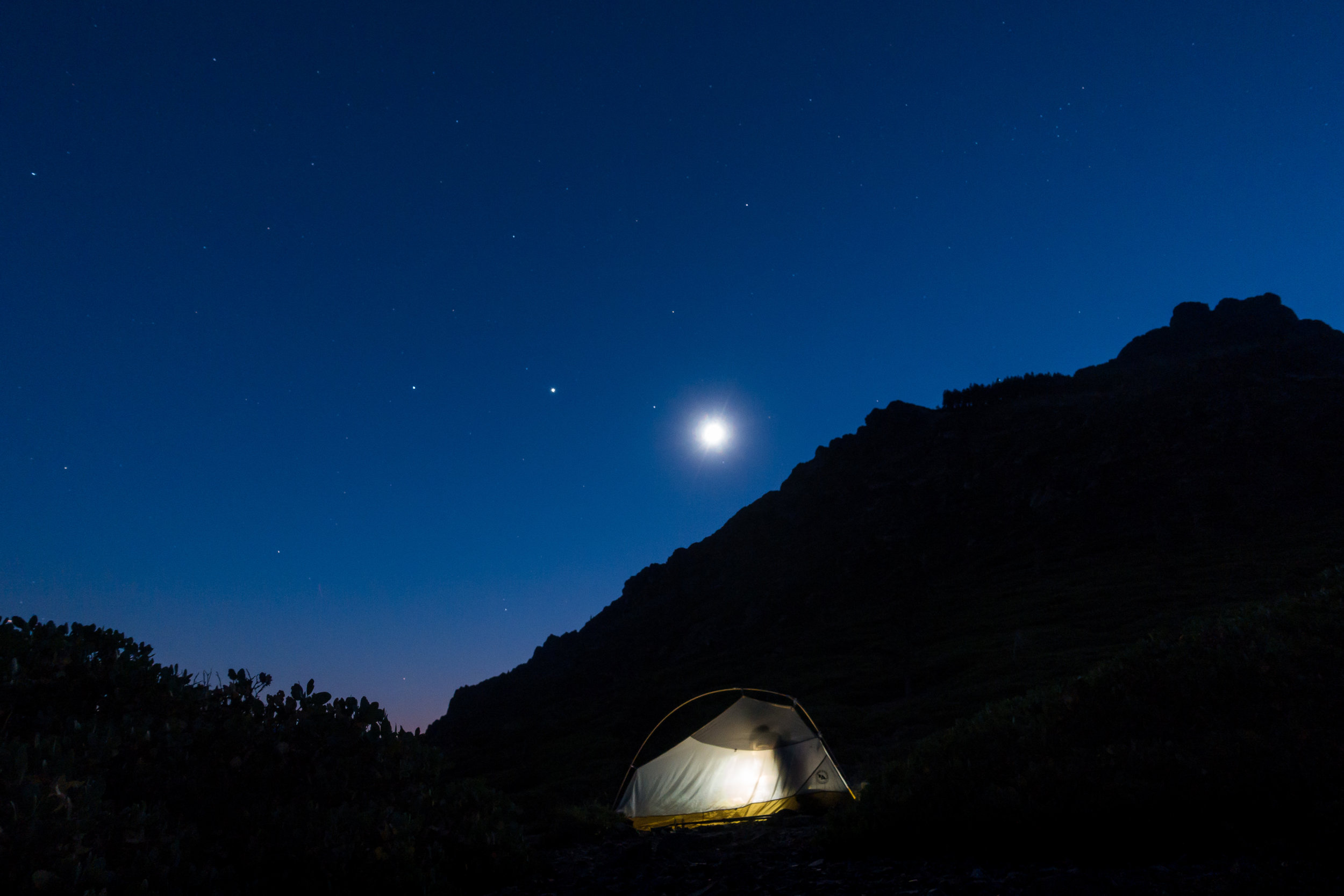
My alarm went off at 4:45 am. We talked through our shelters which we pitched only inches from each other on the small patch we found last night in the dark. We packed our gear, ate breakfast, filtered water from the spring, and started hiking. 

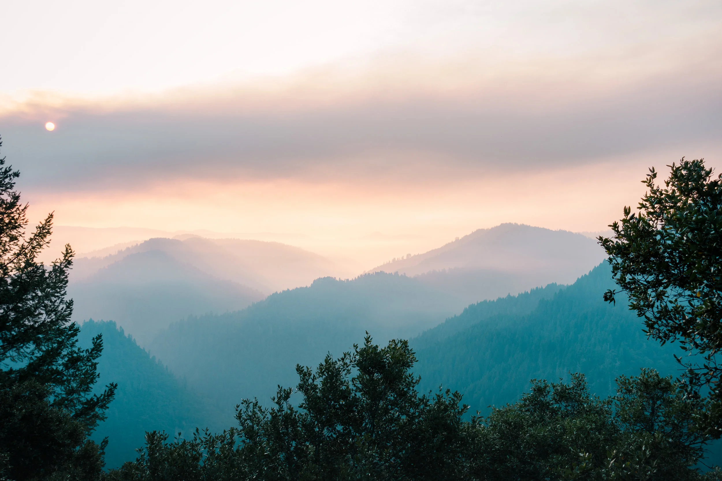
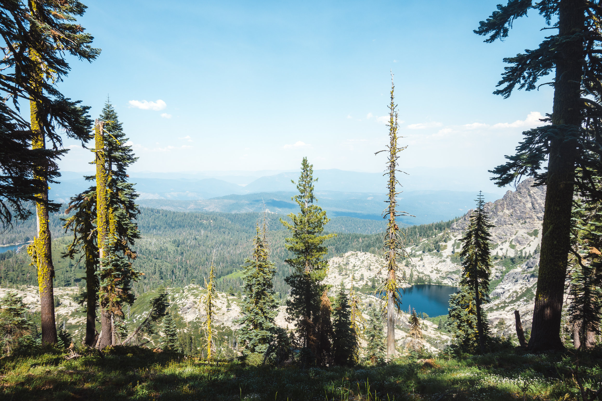
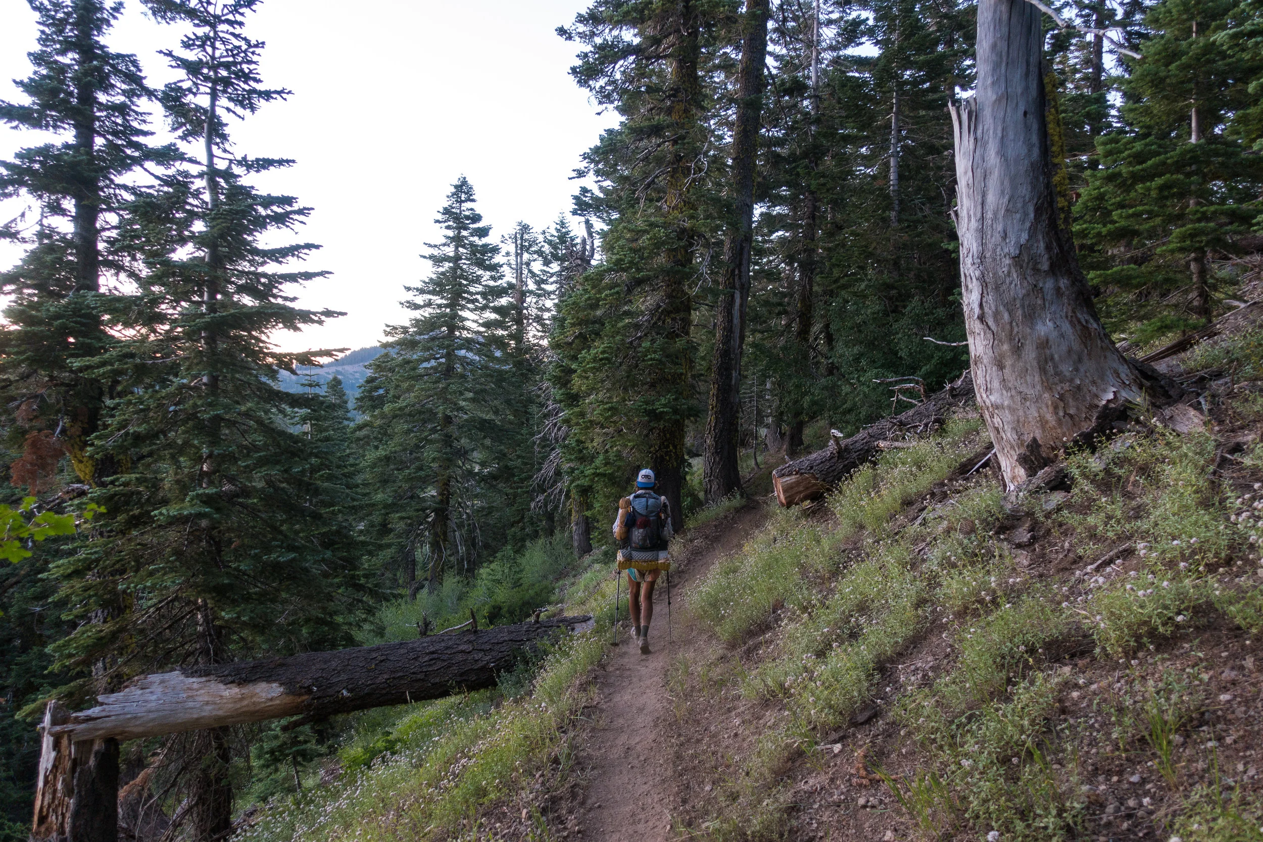
My legs felt sore and like they didn't have their usual spring on them. We wobbled on until our muscles warmed up and then increased our speed and pace. Instead of talking, we just listened to music and moved through the forest, watching the smoke from the wildfires still filling the valley below us. 
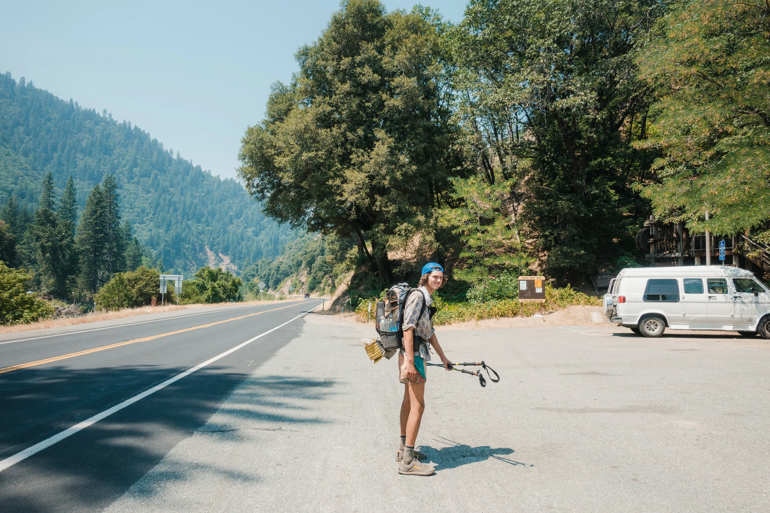
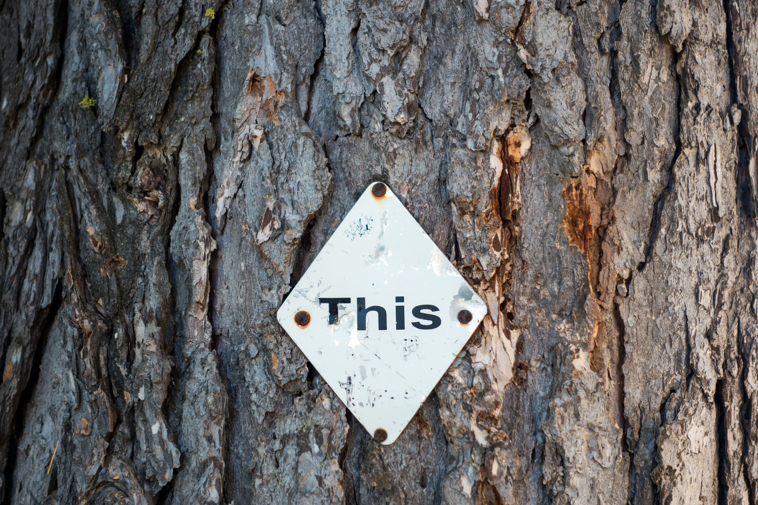
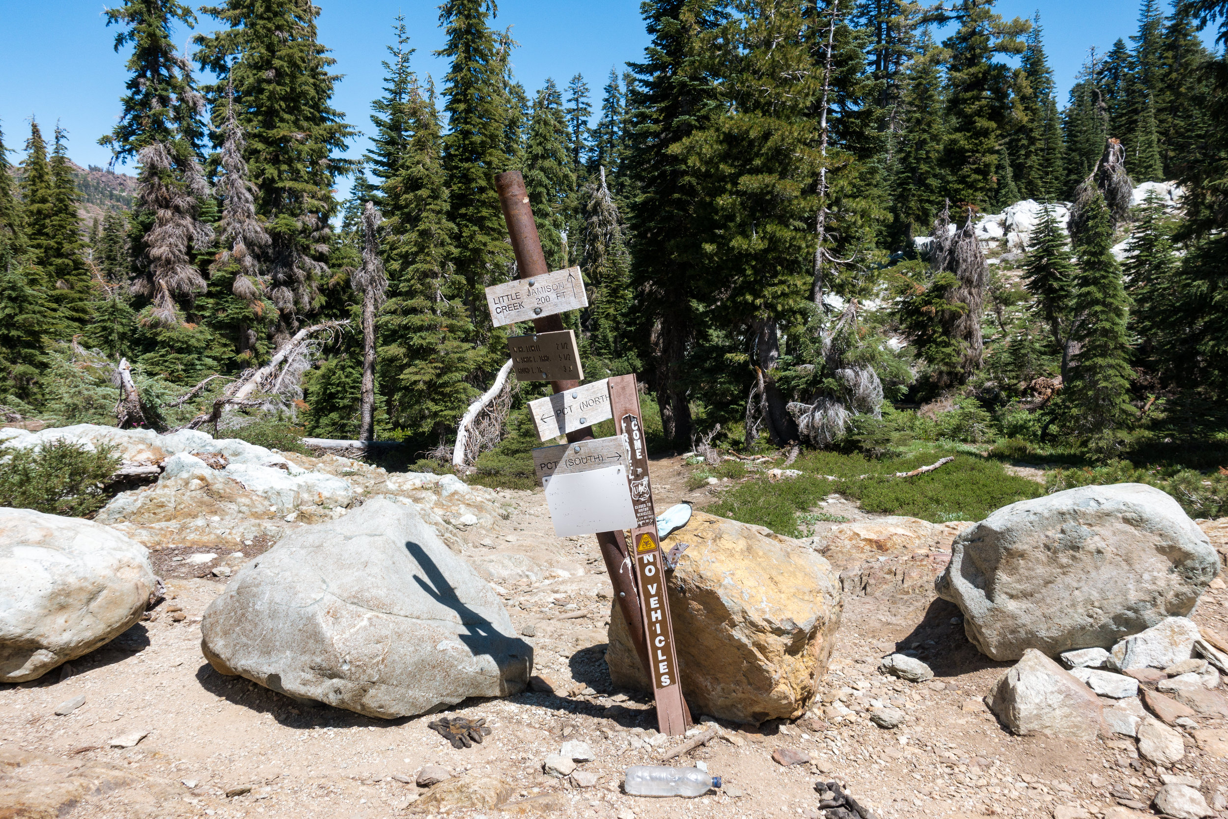
This way to Canada.

This way to Canada.

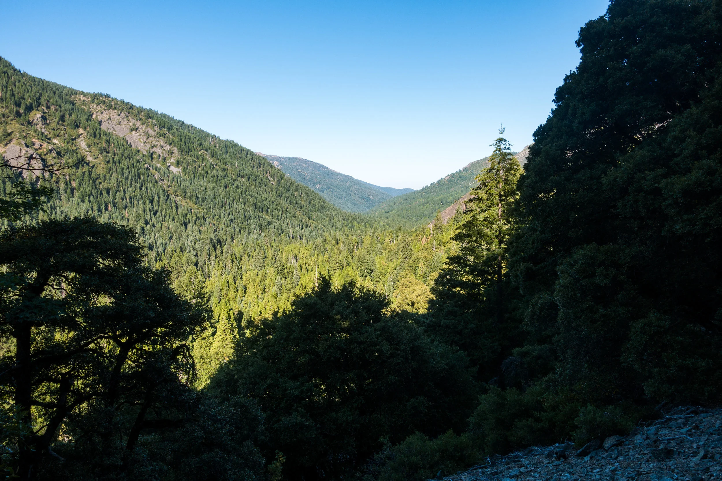
When we spoke, we jokingly complained about the trail and how tired we were. It didn't take long for the sun to heat up the air and make the hiking even more miserable. I wasn't enjoying Northern California at all. It was like the desert, but somehow even hotter, and with views that could be at best described as "meh". 

I felt like the trail designers had noticed that there was not much to see here, and decided to go back to making the trail do unnecessary loops around every possible hill, adding tons of PUD’s (Pointless Ups and Downs). We would first start by going north, then do the same distance back south, then turn east, then to west, back to east, and so forth.

I feel frustrated, hot, and miserable. As the trail peaks out of the cover of the trees, the sun really starts to beat down on us. I curse the heat and pray for a rain, clouds, or tree cover. I miss my umbrella every day. After a while, the trail gets back under the trees but they provide little protection from the overwhelming heat. I try to eat my snacks while walking but I'm basically drinking chocolate bars out of their wrappers as they all have melted already. 

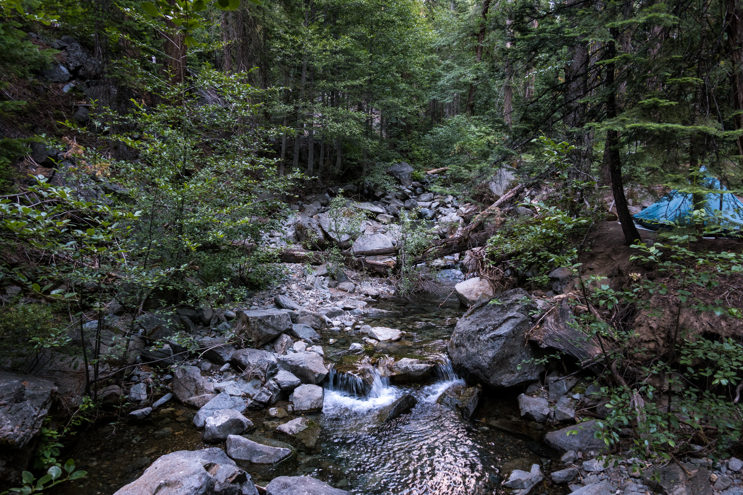
Despite all of this, we reach our first water source and lunch spot early. As most of the water sources on this section, the spring is about 0.3 miles off-trail, down in a deep gulley. We climb down and find a nice, shaded spot to sit in. 
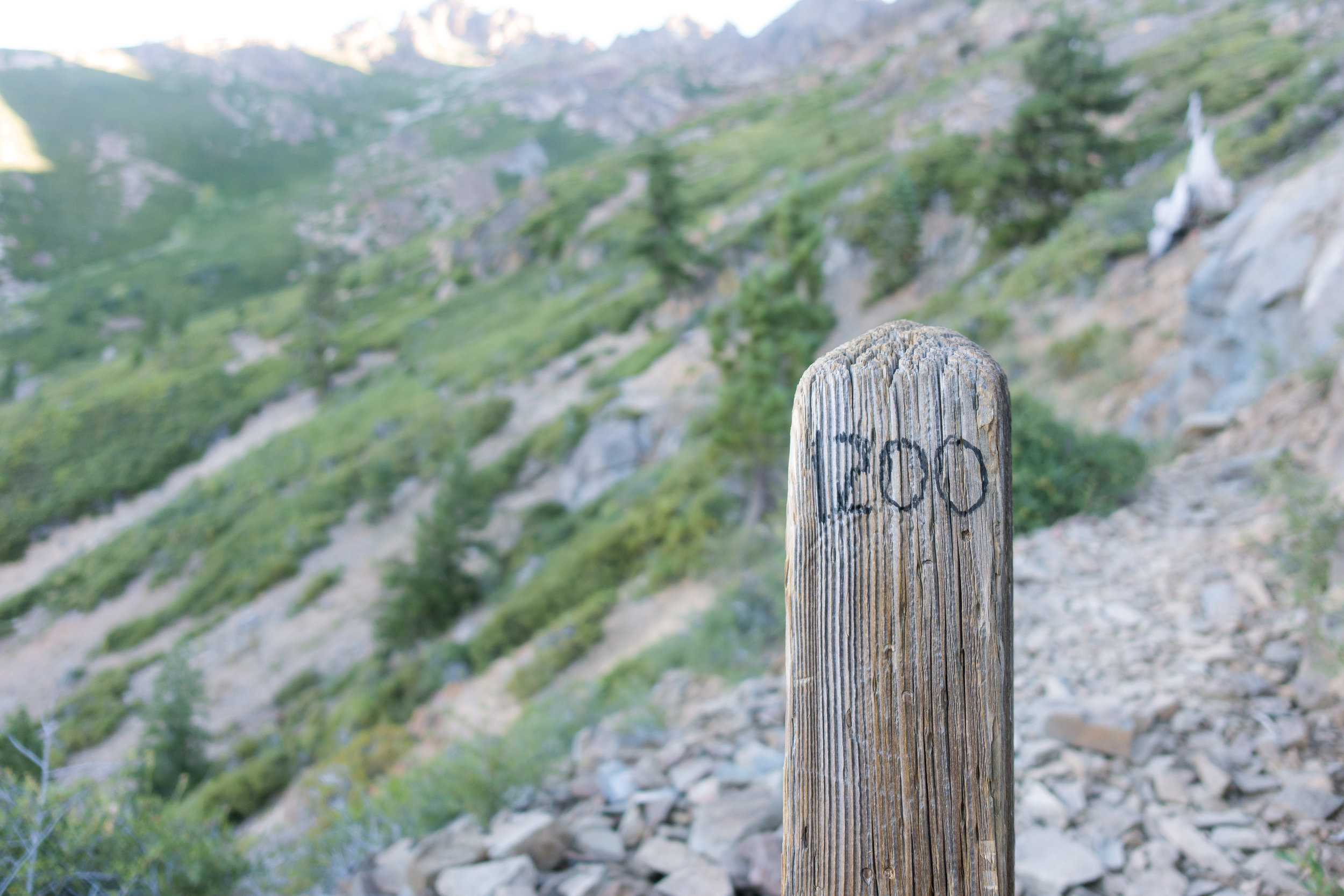
The midpoint.

The midpoint.

We eat our breakfast and talk about all the milkshakes and pizzas we would eat once we reach the town. After I've eaten I feel really tired and relax a little. The next thing I know, I wake up and see Sam sleeping where he was previously eating and an hour has passed by. 

I feel better after the little nap, but we lost an hour of hiking time, and we're still very tired. We need to get moving as the sun has turned around and we're now exposed and sitting in the burning sun. We have about 16 miles to the road, and only 9 miles to the PCT midpoint, our highlight of the day. 

We take more water with us as the water sources are scarce on the next section, and then climb back up on the trail. It's even hotter now and my temperature meter shows around 100 degrees (39c) in the shade and maxes out in the sun. Ugh. Even though my body has already accustomed to the hotter climate, this kind of heat is too much for me.

We do more pointless climbing. We climb up on a hillside only to climb back down to the elevation we began climbing from. We’re not even climbing over anything, we’re just walking up and down on the same hillside to gain and lose elevation for the fun of it. I curse the trail designers in my head. I guess this is how you inflate those elevation metrics for the trail. 

Usually, I can do about 5-10 miles on the 0.75 liter bottle I have on my shoulder pouch, but today I have to stop mid-climb to filter more from my reserve bottle. Even though I'm doing good mileage, I'm not enjoying the trail at all. It's no wonder most people quit at this part of the trail. 

The last miles before the PCT midpoint go by so slowly. I've fallen behind of Sam and can't see him in front of me anymore. I start to get really close to the midpoint and take out my camera, expecting to soon see Sam waiting for me. Instead of Sam, I see a baby deer as she stares at me from the trail, and then runs off with her mom. As the deer move off the trail, I see the midpoint marker right behind them. But no Sam.

We've done this much already.

We've done this much already.

We still have this much to do.

We still have this much to do.

I rush to put my hand on the marker and let out a little yell. I guess Sam had gotten tired of waiting for me and hiked on. I write my name on the trail register and take few photos. As I'm taking these, I hear noise from the trail and see Sam walking down towards. Somehow I've managed to pass him without noticing. 

We celebrate reaching the PCT midpoint and take tons of photos. Reaching the midpoint is our biggest accomplishment so far. We've hiked halfway from Mexico to Canada. At the same time, it's has a bittersweet aftertaste. We've only hiked halfway.

For me, at this point, I've spent three months and a day on the trail and I'm only halfway through. I think back on all of the miles we did in the desert, and through the snowy Sierra, and how long those felt. And I still need to do the same amount of miles, but in less than two months, to reach Canada before the end of September and the coming winter. I feel like this point underlines how long the trail really is. 

Happy to reach the halfway point.

Happy to reach the halfway point.

And when you realize you're only halfway done.

And when you realize you're only halfway done.

After we're done with celebrating and taking photos, we shoulder our packs and start hiking again. We're late on our schedule and will get to town late in the day. 

I'm almost out of water and Sam is low as well, and the next water source is almost five miles (8km) away. We need to boogie. We still do good time moving down the trail but it just doesn't feel good. I complain to Sam about Northern California most of the way down and he keeps laughing while walking behind me. After a long rant, I start to feel better but still tired. We both agree that this has been one of the worst days on the trail. 

The last mile to the water source goes by way too slow. I check the GPS and it says 0.6 miles. We walk for what feels like an eternity and I check again. 0.5 miles. Oh, come on!

As we finally reach the water, we quickly filter some water, camel up, and then keep hiking. We want to get to town so we start flying down the trail.

Sam writing to the trail register.

Sam writing to the trail register.

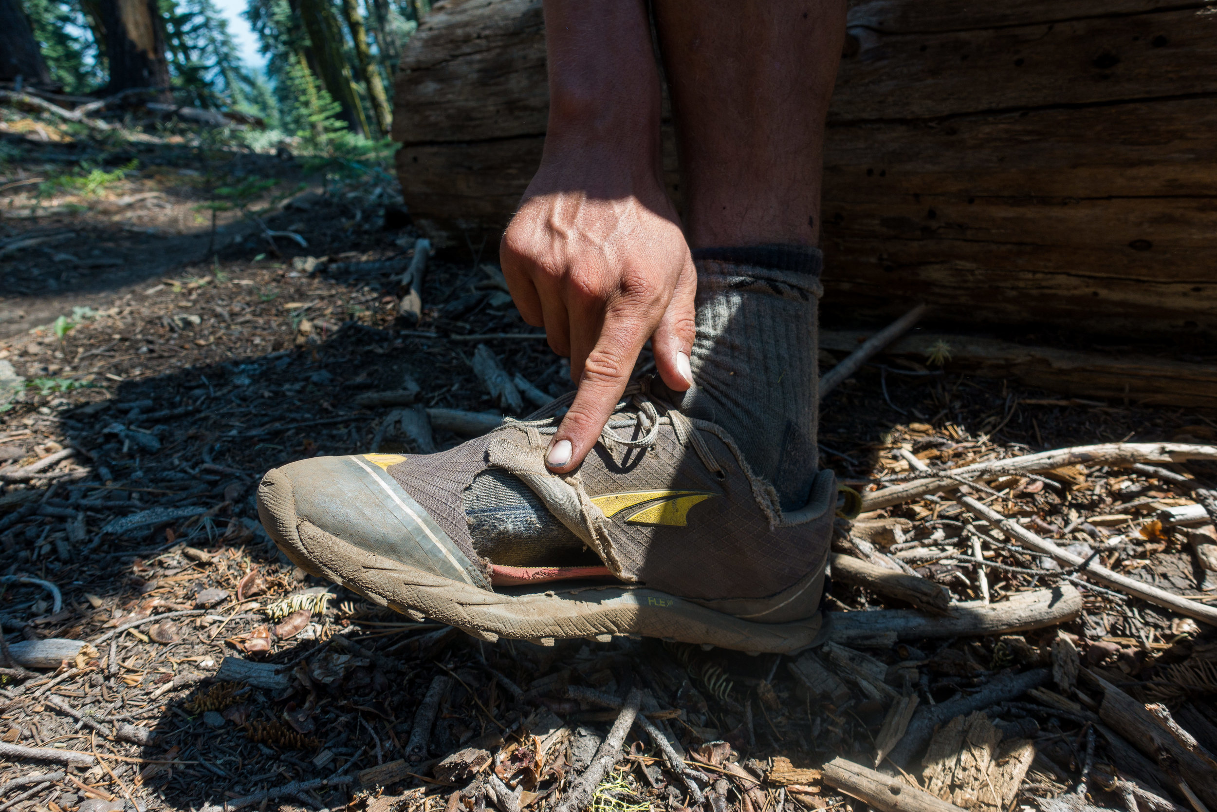
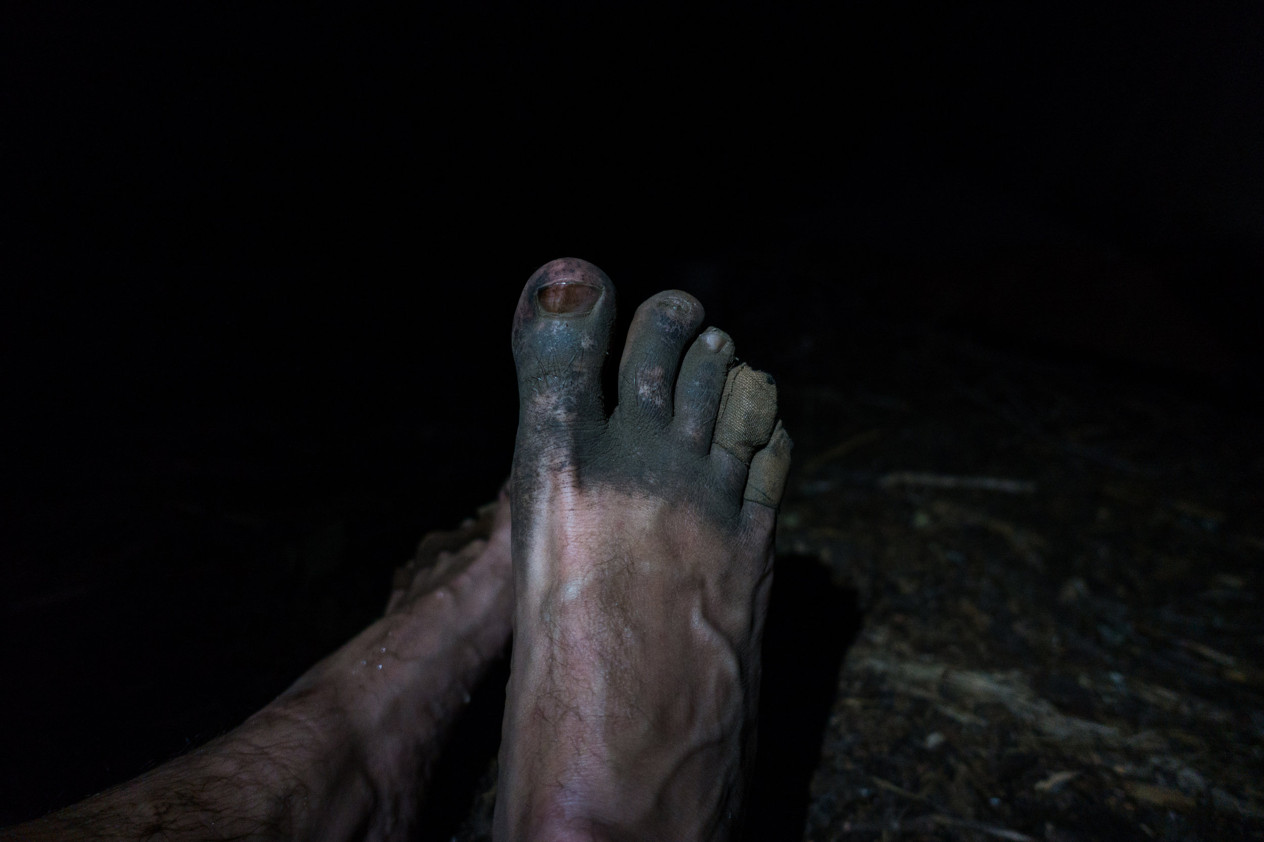
To finalize the day, the trail decides to treat us with a half a mile of overflown, muddy section of the trail, right before we reach the road. It's so much more fun to try to hitch to town when you’re covered shin deep in mud and have wet, smelly shoes on. Even without the mud, we are a pretty dirty sight.

Once on the road, we soon get a ride to town and get the ride straight to the milkshake and burger place in town. We eat burgers and drink the massive milkshakes. I get a message from Fire Ant telling that they didn't stay in-town and instead went directly back on the trail. Roller has gotten back on the trail as well and heads out with the others. I also hear that Sunshine has stayed back in Quincy for few zeros with her friends. That explains why we didn't see her name on the trail registers.

While Sam stays in the restaurant, I run across the road to see if the hotel has any empty rooms. They have only one suite but I manage to Yogi the price down to what a regular room would cost. We’re sleeping in style tonight!

After eating we get to our hotel, wash our gear, take showers, and vegetate on our beds watching TV while planning for tomorrow and the next section of the trail. I need to get to the Post Office early in the morning to get my Amazon order. Finally, I get the bigger battery bank and I’m able to edit photos and videos while on the trail. I also ordered a new spoon as I hate the Vargo spork I bought in Kennedy Meadows. I have to bounce my bounce box to Ashland as I have no need for my rain gear, thermals, or mosquito net now. 

I also need to find a new hiking shirt as the one I'm currently wearing doesn't breath at all and I'm just suffering every day on the trail. But that's going to be hard as there are barely any shops in town. 

I lean back on my large bed and enjoy the feeling of being clean and being inside where there's AC. Sam cranks the AC down and soon it's as cold as it’s in Finland but I can't complain. Sure beats sweating outside.

After not showering and being in towns for 238 miles (383km), it sure feels great to be back in civilization. 

Day 93: Belden, my least favorite town on the trail

DSC03902.jpg

Date: July 31, 2017
Miles: 24.5 miles (39.4km), from mile 1,278.4 to mile 1,302.9. 
Health: Tired but happy.

The entire night I hear the sound of music and bass thumbing coming up from the valley. I’m happy I didn’t go down there for the night. My plan of having a peaceful layover in Belden tomorrow, and working on my blog, seems unlikely.

I wake up early and as I’m getting my gear ready I hear Sam’s voice from the outside – he caught up already. I jump out and get my gear together and we start the steep descent down to Belden. As soon as we leave the saddle the trail turns around the mountain and we start wiggling down what seems like endless switchbacks. The mountainside is so steep it looks like we’re walking down a vertical wall, with each switchback on top of each other. We make comments about how happy we are not having to climb up this wall, knowing fully well that the climb out of Belden is far worse. 

As we hike Sam tells me about his adventures in Quincy. There were fires around the town and everyone was on a constant alert to evacuate the town. Apparently, someone had dressed up as a Forest Service worker and set eight different fires in the surrounding forests. I don’t understand some people at all.

Entire "town" of Belden.

Entire "town" of Belden.

In few hours we descend 5,550 feet (1,690m) and reach the bottom of the mountain. As we step out of the forest, the trail ends right on railroad tracks. We look for a safe spot to cross and then the scenery changes like it was cut with a knife. We arrive from a lush, green forest and end up smack in the middle of an aftermath of a massive party. There are poorly constructed, barely standing tents and shacks everywhere. People passed out naked in the middle of the street, trash, and garbage everywhere. And the few people that are up, walk like zombies around the now completely wrecked main street of Belden. The smell of urine, alcohol, and herbal medicine lingers in the air to remind us how much better the air smells up in the mountains.

Bridge out of Belden.

Bridge out of Belden.

We walk through the destruction with our mouths wide open, not knowing what to say. We find the restaurant slash hotel slash general store and head in for a breakfast. Inside we find more zombies in different states of hangover and nakedness. Some are passed out, some are starting to get hyped again, and most are somewhere in between. The dress-code among the zombies seems to be “dress as a major douchebag”. I’ve never seen this many top-hats and fedoras in one place.

We try to find a table outside, far from the zombies but as they are everywhere, our attempts to find peace and quiet are futile. After wasting 30 minutes trying to hunt down a waitress we finally manage to order breakfast. It becomes painfully clear we don’t want to stay here any longer than we have to. We find outlets that are out of sight and put our electronics to charge.

Sam next to Eby Stamp Mill

Sam next to Eby Stamp Mill

While I might not get to relax and work on my site, at least I can use the toilet here. Sam looks after our gear and I go to find the toilet. As I open the toilet door I’m greeted by the most awful sight I’ve ever seen. There’s literally shit in the sealing, the floor is overflowing with what I can only assume is a mixture of different bodily fluids, and there’s not a single clean surface in the entire room. Who would treat a toilet like this?!? There’s no way I’m going inside.

I return to the table, disgusted. James and few others have caught up with us and we all agree this is the last place we want to be right now.

After the breakfast, we order our check and I give Sam some money to pay while I go visit the general store to fill my empty food bag. The selection is pretty minimal but I find the thru-hiker stables: mashed potatoes, chocolate bars, and candy.

I get back to our table to see if we can already leave but we haven’t received our check yet. I go talk to the waitress and ask for our check. She tells me she’ll be right over. Sam goes to the grocery and I wait for our check.

Sam eventually gets back but still no sight of our waitress. I go over again and she apologizes and says she’ll be right over. Eventually, she walks over to our table but instead of our check, she asks what would we like to order. I explain for the third time that we’ve already eaten and would like to pay. She apologizes and heads back inside.

Back on the trail, looking back over the river to Belden.

Back on the trail, looking back over the river to Belden.

We keep waiting but she never comes back. I go back in to search for her again. Finally, she comes over and we settle our bill. She apologizes again, telling us she’s been partying all night and hasn’t gotten to bed yet. I can’t tell you how badly I want to leave this place. We shoulder our packs and head over the river to get out of Belden as quickly as we can.

After a short walk along the highway, the trail heads back up to the mountains. According to the Guthooks app, we’re looking at a 6,200 feet (1,890m) elevation gain. Thanks to all the time we lost while waiting for our check, we’re starting the climb in the middle of the hottest part of the day. While climbing for hours in the midday sun is not fun, it’s still better than staying in Belden.

Sam dipping in a stream to cool off in the heat.

Sam dipping in a stream to cool off in the heat.

Rattlesnake spring.

Rattlesnake spring.

The first 5 miles (8km) are completely exposed and we get no cover from the sun. It’s so hot that we have to stop on every small stream and water crossing to cool off. At one larger stream, we stop for awhile and while Sam picks some blackberries, I submerge myself completely in the rapids. Having the ice cold water rush through your clothes feels amazing. Sam just dips his torso in the water. We eat a quick lunch, dip ourselves in the water one more time, and then get back to climbing.

The heat is so bad that every time we come to a small stream, I pour five or six liters of water over me, getting all my clothes wet. This causes me to shiver for a few minutes but the heat dries me up quickly and I’m back to boiling. I wish I would still have my umbrella to have even a little bit of shade.

Sam entering Lassen National Forest.

Sam entering Lassen National Forest.

Author entering Lassen National Forest.

Author entering Lassen National Forest.

Crossing streams on our way up.

Crossing streams on our way up.

Nice, big, log crossing.

Nice, big, log crossing.

We finally reach little tree cover but it does little to the heat. The air is over 100 degrees (38c) in the shade and we just keep climbing. This has been the most brutal climb along the entire trail so far.

Eventually, we get to the top. I look at the clock and it took us over 7 hours to climb up. It’s getting late and we still have a long way to camp. Going down feels amazing but it’s starting to get dark.

Tired and happy to be done with the climb.

Tired and happy to be done with the climb.

Crushing the last 5 miles (8km) before we lose the light.

Crushing the last 5 miles (8km) before we lose the light.

Crossed 1,300 mile (2,093 km) marker today.

Crossed 1,300 mile (2,093 km) marker today.

We reach our camp spot right as the last rays of light disappear behind the mountains and it gets dark in the forest. Our camp spot is right along a small dirt-road and I see few horse trailers little way down the road. While Sam goes to look for a spot to camp, I walk over to say hi and to see the horses.

I announce myself ahead so I don’t scare anyone, suddenly arriving from the dark, and I’m greeted by smiles and hellos. There are six people sitting outside and they tell me they’re out here helping with trail maintenance. We talk about the trail and I learn all kinds of things about riding along the PCT on a horse. As I’m starting to head back to set up my shelter, the nice people offer me food. As we’re always hungry, I can’t say no. They fill my hat with homegrown tomatoes and top it off with a barbecued pork chop. 

I thank the nice people, say goodnight, and walk back to the spot where we planned to camp. Sam doesn’t want any of my loot so I get to eat all of it. While the tomatoes are delicious, it’s the pork chop that really takes the price. A big, greasy piece of salty meat after a long day like this is pretty much perfection. I don’t need to make dinner so I save some food and get to bed earlier.

We camp huddled under a large tree, right next to a horse trough – our water source. It was a long day but I’m happy we got out of Belden. Tomorrow we need to get up early and get to Chester. 

Day 92: California is on fire

norcal-wildfires.jpg

Date: July 30, 2017
Miles: 26.2 miles (42.2km), from mile 1,252.2 to mile 1,278.4.
Health: The NorCal heat is really getting to me.

We woke up in the morning and could smell smoke all around us. As we got out of our shelters, we could see that everything around us was covered in smoke. There was no ash raining on us so we weren't too close to the fire, but there was definitely a fire somewhere close. 

We had no other options other than to hike on so we headed out. Sam left first and we agreed to meet later when he has his breakfast break. I took more time to leave as I wanted to enjoy the last bit of my granola while sitting down. I still remember when I would eat my breakfast while hiking. The trail has slowly worn me down and little things like eating while sitting down feel like little luxuries.

As I was about to leave, the section hiker girls who we shared the camp spot with, woke up. I didn't want to carry anything extra for the climb, so I gave them my extra 2 liters of water. I knew I could make it to the next water source with the 0.75 liters I had. 

I started walking out and after about ten minutes of walking, I started wondering why my shoes felt so weird. Looking down I noticed I had forgotten to tie them when leaving camp. One of those mornings. 

Sunrise through the thick smoke from the wildfires.

Sunrise through the thick smoke from the wildfires.

As I climbed higher and got out of the thicker forest, I saw everything around me covered in smoke. The sunrise looked so strange as the smoke turned all the colors to tobacco yellow. Hiking on I kept hoping I wouldn't walk up to a wildfire.

The climb was much easier than I had thought and I soon caught up with Sam who had already finished his breakfast. He was just wondering where I was. I guess I was slower than I thought. 

We hiked on and kept climbing while talking about heavy metal. We talked in depth about the differences in lyrics of Metallica, Iron Maiden, and Slayer. And then about the live shows of Iron Maiden. It’s amazing how much faster time goes when you have something to talk about.

Time went by fast and after two and a half hours of climbing we reached the Lookout Rock at the top of the climb. The views would have been great but all we could see was smoke. We found a hiker resting on the Lookout Rock and he told us that the fire we saw yesterday was about five miles down from here. Or just two canyons away. So we really were correct to be worried about the smoke yesterday.

He told us how he had spent the entire night watching planes dropping water and headlamps moving around the fire. From up here, he had unrestricted views to see the entire thing go down. We could still see the smoke rise from the burn area but the flames were down by now. Wildfires seriously scare me.

sam-on-pct.jpg
Sam and I on the Lookout Rock. Behind us is the area that was on fire.

Sam and I on the Lookout Rock. Behind us is the area that was on fire.

We took few photos on the ledge and then headed on. Sam was only hiking about thirteen miles with me as he was heading into the town of Quincy today. His resupply package didn't arrive into Sierra City so he was running out of food and needed to get more. I was trying to stretch my quickly emptying food bag all the way to Chester, still over 60 miles (96.6km) away. 

My plan was to make it outside of Belden tonight. Belden is a small resort right on the trail. Tomorrow morning I would head in, eat breakfast and lunch in town, buy as many snacks and food as I can, and maybe pack out a burger. I'm hoping this, and what little I have left, will be enough to get me to Chester where I can do a proper resupply. 

Sam needs new shoes soon.

Sam needs new shoes soon.

Marveling at the beautiful NorCal wildflowers.

Marveling at the beautiful NorCal wildflowers.

norcal-flowers.jpg

As we finally reach the road to Quincy, Sam gets a hitch immediately. We don't even have time to make arrangements, we just fist pump as he hops in the car and speeds off and I'm left on the side of the highway alone. As I cross the road and am about to get back on the trail I see pit toilets a little further down the road. One can't simply pass an opportunity to sit on a real toilet so I head down there to make a deposit. 

Soon I'm back on the trail and looking at an over 1,500 feet elevation gain in the beating midday sun. Climbing again. At the start of the climb, I find a trail register. As I'm signing my name I notice Dandelion, Fire Ant, and Roadrunner have signed it earlier today. How on earth did they get past us?!? They were supposed to be behind us? And where's Sunshine? I can't see her name in the register. 

DSC03880.jpg

As I keep hiking up the extremely hot mountainside, I keep wondering how did they get past us without us noticing. It must have been either yesterday as we were down at the river, or when we were camping. Our camp was a little off trail, in the trees. They could’ve easily walked by not noticing us. 

Although it's one o'clock, and I've already hiked over thirteen miles, I decide to skip lunch and just hike without breaking by just eating snacks. I'm hoping that this way I could maybe gain some ground on them. Unless they hiked really far past us yesterday or got a really early start, I don't think they're trying to get to Belden tonight. That would mean I have a good chance of catching up with them. 

I pass a southbounder on the way up and ask her if she's seen Dandelion, Fire Ant, and Roadrunner. She hasn't. Strange. I pick up my pace and pass another PCT hiker on the climb. It's getting close to the infamous three o'clock heat and as the entire hillside is exposed to the sun with no shade, I’m basically melting. I have to take off my shirt and dunk it into one of the streams I cross to cool down. That helps a little bit but in this heat, the shirt is dry again in twenty minutes. 

DSC03882.jpg

Almost at the top of the climb, I run into James. He's getting water at one of the streams and I join him. I ask if he's seen the trio and he tells me he camped with them at the top of the climb last night. And that they had a really early start. Dang. That means they're pushing to Belden today and I won't catch them. I could make it to Belden by tonight but it doesn't make any sense as the camping there is not free, and I’d rather sleep out here in the mountains than down at the resort. James also has no idea where Sunshine is. Strange. I wonder if she stayed back with Kendall for some reason?

The entire day I've watched the fire planes flying over in formation. James tells me the fire was started on purpose and that the authorities have already arrested a suspect. That's unbelievable. Who would intentionally start a fire in a place like this and put so many lives at risk? 

As we sit by the stream with James, we redo the "how many miles we need to hike in a day to reach Canada before winter" calculation. I'm still on course to make it there by the end of September. If I keep one zero-day per week, I need to hike 25.5 miles (41km) per day to get to the Northern Terminus by the end of September. Considering that I'm easily doing that now, and Oregon is where we're going to be doing 30's, I should be fine. Why do I feel like everyone else is speeding ahead? 

If I calculated correctly, Cannonball and Storyteller are about 80 miles ahead by now. And Topo is over 4 days ahead according to James. And DG is about the same. And now the girls are also ahead. I feel like I should start rushing but I don't understand why? Do people want to end the trail faster? Or is there something else I'm not seeing? Is my math not correct?

DSC03888.jpg

I keep hiking on and wondering should I start pushing it harder, and not enjoy the trail as much, or just take my time and enjoy it as much as I can. Everyone's going to push maximum miles pretty soon and catching up to anyone at that point is going to be almost impossible.

I fear that if I start pushing harder I might break my body, or worn myself down mentally. But I’d also like to catch up to my friends ahead so I could finish the trail with them. I’m happy Sam is hiking with me. He definitely could go faster, I’m just not sure if I could.

James standing on the only spot where there's little cellphone signal.

James standing on the only spot where there's little cellphone signal.

On top of one of the climbs, I see a familiar backpack laying on the side of the trail. It's Sunshine's pack! Her poles are also there but no sight of her. I try to look around but can't see her. I get on a rock and start yelling her name. No answer. I keep yelling for awhile and then I hear someone yelling from behind me, it's not Sunshine. It's a hiker I've never seen before and she was enjoying the views and reading out on the ledge. She just happened to have the same backpack and poles as Sunshine.

I make the last few miles to the camp spot up on the hills, right above Belden. No sight of the trio and there are no possible camping spots between here and the town. Unless I see them tomorrow at the resort they've pushed a day or a half ahead of me as I'm stopping in Belden to eat and recharge my electronics. Also, I promised to wait for Sam there. 

mld-patrol-tarp.jpg

I set up my camp but it's still too early. I'm camping on a saddle quite exposed, and the winds could pick up at night, I try to find rocks to hold my stakes in. I walk back up the trail a little and pick up a larger rock from the ground. As I reach for the rock I see something moving next to me. A rattlesnake. She's colored with white and black stripes, just like the one we saw climbing up from Sierra City. She was apparently warming up in the evening sun by the side of the trail and I disturbed her. As she disappears into the brush next to the trail she gives me a little shake of her tail. I count six rattlers. 

While I have a healthy respect and fear for the snakes and other animals around here, I just can’t get over how beautiful they are. These mountains are their home and we are merely quests here, passing by. Trying to cause as little disturbance as I possibly can is something I keep thinking every day.

I eat lunch and dinner while enjoying the beautiful sunset. James comes by and we chat for a moment about cell signals and keeping a blog while on the trail. His blog is here. James continues down to the next camp spot and I get to keep the saddle to myself. There are already three others on the lower spot, and it's more exposed, so I'm happy to be up here. Tomorrow morning I'm eating my breakfast in Belden after a short and steep 6 mile (9.7km) hike downhill. 

Day 91: Who said Northern California is easy?

DSC03818.jpg

Date: July 29, 2017
Miles: 23.1 miles (37.2km), from Whiskey Spring to mile 1,252.2.
Health: Feeling rested after a short day.

We woke up at 5:30 am but stayed in our sleeping bags and talked until it was time to go. Sam took his turn to get us water from the spring and then we climbed back up on the trail. I could definitely feel yesterday's miles, my feet were lacking the usual kick and lightness. 

The trail was fast again but we spend some time log hopping as there were a lot of fallen trees on the trail. The winter storms have downed a lot of trees and the trail crews haven’t had time to make it up here yet. After about an hour of hiking, I have to stop to go dig a hole in the woods and Sam keeps hiking. We’ll meet when he stops for his oatmeal around nine o'clock. 

As I’m catching up to Sam, I run into a trail maintenance crew on their way to clear out the trail from all the fallen trees. I share my information about the location of the worst tree jams and thank them for keeping the trail so well maintained. As I get little further on I hear the sound of a chainsaw, they must be working on the large log jam I climbed over just before running into them. The hikers behind us are going to be happy. 

Sam getting water.

Sam getting water.

I soon catch Sam and he has already finished eating his breakfast. The water source is again far off the trail so I leave my pack with Sam and with his instructions climb down the hill to the spring to get more water, and then back up. 

After all the plentiful water in Sierra, we're getting back to areas where we need to keep a closer eye on the water situation. I'm still only carrying 0.75 liters and cameling up at water sources, but that might not be enough soon. We have about three longer water carries coming up and currently, I don't have the capacity to get through them.

We're both a bit tired and I feel like I didn't get enough sleep last night. The sun is already out in full force and we both keep complaining about the heat as we hike on. Even though the trail is mostly under the tree cover, the air is still too hot for me. I keep hoping for a cold front or a rain to come by. 

Sam filtering water.

Sam filtering water.

We make the 13 miles (21km) to our lunch spot on a stream 800 feet off the trail and climb down to where the water is. We sit in the shade, drink water, and make our lunch. Even down here in the shade, it's still hot. Apparently, this heat is not going away until we hit the rains in Washington. I groan at the idea of over 700 more miles of this. 

As we eat we take a look at the elevation profile for the rest of the Northern California as we’ve heard it's supposed to get easier. Although the trail looks to flatten a lot after Chester, there are still many over 4-5 thousand feet (1,200 - 1,500m) climbs coming up. Almost every town we go into has a long climb out. Why do people say Northern California is easy?

After a long lunch break and a little nap, we climb back on the trail and keep hiking. The midday heat hits me immediately. I just don't enjoy hiking when it's this hot. We look at the map and see there’s a big river coming up and the comments on Guthooks say it’s supposed to be a great swimming spot. The heat is just too much so we decide that once we get there, we’re stopping for a swim break.

Reaching the bridge to cross the river.

Reaching the bridge to cross the river.

We climb up for a long time and then climb down for an even longer time. The sound of the river can be heard from all the way up but we still have a long way down to it. The trail is really overgrown at times and we keep having to push ourselves through the really thick brush. Some of the plants have thorns and my legs and hands are getting cut. Sam has some old wounds that start bleeding again.

When we finally reach the river it looks gorgeous. We cross the bridge and then drop down to the riverfront. I jump in with all my clothes on, laundry and shower at the same time. I also wash my socks and gaiters as they're starting to get really dirty. 

We swam around the bend, above these small rapids.

We swam around the bend, above these small rapids.

We sit in the cool river for about 45 minutes and then start getting ready to leave. As I'm getting my shoes on I notice an odd cloud behind one of the mountains and make a note of it. I see just a small part of the cloud but it looks troubling. Looking at it, I notice the cloud is not moving but is growing upwards. That's not a good sign. 

I mention this to Sam and we both look at the cloud and go back and forth analyzing whether it's a storm cloud or a tower of smoke. From where we're at, we can't tell for sure, and it doesn’t look to be directly on our path, so we start hiking but keep our eyes on the cloud constantly.

Some way up the trail we get a better view and as we're watching darker smoke rise from behind the mountain, and see planes dropping water around it, we know for sure we're looking at a smoke plume. We haven't heard of any fires in the vicinity, but it could be a new one. The smoke looks to be some way further and not in the direction we're heading. 

I'm not really comfortable with wildfires, it’s something I have no experience with. To be totally honest, seeing them this close stresses me out a little. I have no problem with river crossings, snow, high altitudes, heat, bears, snakes, or anything else on this trail, but I’m genuinely afraid of the wildfires. I know they can move at a rapid pace and knowing we can only move at about 3-4 miles per hour–that’s some math I’d rather not do. I’m constantly hoping we're not waking up to a forest fire right around us. 

From the river, we have a long, over 3,300 feet elevation gain. As we've already done 20 miles today, we really don't want to spend the rest of the evening climbing all the way up to the top. So we decide to only climb one-third of the way and do the rest in the morning when the air is cooler. 

Bridge over Bear Creek.

Bridge over Bear Creek.

Bear Creek.

Bear Creek.

After the first part of the climb, we descend all the way back down to the Bear Creek (not the famous Bear Creek in Sierra), and immediately start climbing back up. We stop to get water for tonight and tomorrow morning, as we're dry camping higher up the mountain, and then keep hiking. 

Getting water to camp.

Getting water to camp.

We get to the camp little after six o’clock, which is early, and set up our camp. There's a group of girls section hiking the PCT and we talk with them for a while about the trail. Then we hop in our tents to escape the mosquitoes and start to eat our dinners. I’m trying to cold soak couscous mix I found in one of the hiker boxes but it’s not looking good. I try to eat it but I simply can’t, no matter how hungry I am.

My MLD Patrol Duo next to Sam's BA Fly Creek UL 1.

My MLD Patrol Duo next to Sam's BA Fly Creek UL 1.

First and last time I eat couscous on trail.

First and last time I eat couscous on trail.

We had set up our shelters close enough so that we can talk to each other. It's nice to get to camp this early. 

Tomorrow Sam is going to head to Quincy to get more food and I'm trying to get as close to Belden as possible. There's a long climb down and up from Belden and I'm not looking forward to either one of them. I'm trying to stock up on resupplies from Belden to stretch the rest of my food bag all the way to Chester. Belden is just a small resort on the trail so I won't be able to do a proper resupply there, but if I can get some snacks and bars, my food bag should get me the rest of the way to Chester. 

Day 90: First 30-mile day

pct-marker.jpg

Date: July 28, 2017
Miles: 30.4 miles (48.9km), from mile 1,198.7 to Whiskey Spring at mile 1,229.1.
Health: Tired but happy. Knees hurt a little.

I've been trying to do a 30-mile (48,28km) day for a while now but have always felt that I needed to push too much to make it comfortably, or just ran out of daylight hours. Today everything just felt right and I managed to hit the 30-mile marker without too much trying. 

I got up around 6:30 am, expecting Kendall and Sam to have already left. I put my granola soaking and got out of my shelter to see both of them still there. I was a bit tired from staying up too late to take photos of the stars last night. 

Trail out of the camp.

Trail out of the camp.

Sam headed out first, and as Kendall was leaving, she mentioned she was having some issues with her Achilles and that she'd be just seeing how her body feels.

I left about five minutes after Kendall, fully expecting not to catch up to either of them as they’re both faster than me. And there was a big climb right out of the camp which means I’m going even slower. Kendall loves mornings, and I hate them. The combination of an early morning and climbing is the worst for me. 

We crossed 1,200 miles (1,931km) on the climb up.

We crossed 1,200 miles (1,931km) on the climb up.

But I soon catch Kendall as she's filtering water. She doesn't seem to have her usual spring in her steps and I feel a bit worried about her. I ask her how she’s doing but judging from her answer she doesn’t want me to stick around. I push onward keeping my eye on her on every shoulder, trying to see if she has gotten up and back hiking. Finally, as I’m about to turn around the corner to the other side of the mountain, I see her back on the trail way behind.

The climb is soon over, but I’m sweating buckets. It's not even 8 am. After the climb, the trail turns back down and I catch up to Sam while he's eating breakfast next to a forest road. We chat for awhile and I tell him about Kendall. Sam gets up and we both head out together but he says he’s looking to hike solo so I try to let him do his own pace.

Hiking in the shade of the mountain before the sun gets too high up above.

Hiking in the shade of the mountain before the sun gets too high up above.

northern-california.jpg
Trail junction.

Trail junction.

We end up hiking together for a long while and talking about all things the entire morning. I’m setting the pace as Sam wants to go at a slower pace. He's been burning too much energy going at a faster pace. He’s making comments about how much easier it is to hike at a little bit slower pace. I agree.

The scenery in Northern California is very much different from the desert or the Sierra sections. The mountains out here are smaller, there are more trees everywhere, and tons of small lakes. But while the mountains aren’t as high as in the Sierra, they seem to be steeper. We do a lot of up and down climbing.

We eat lunch and wait to see if Kendall catches up to us. After waiting for a while we head back out. My mood is back up thanks to having Sam to talk to while hiking. The miles seem to go faster and you don’t have to spend as much time inside your head. By this point, I’m running out of things to think by myself.

Getting ice cold water from a spring on the side of a mountain.

Getting ice cold water from a spring on the side of a mountain.

Soon we’ve done over 25 miles and it’s not even dark yet. There’s no reason to stop so we keep on hiking. According to Guthooks, there’s a water source called Whiskey Spring little over 5 miles ahead. If we make it there we’ve done over 30 miles today.

Right before reaching the spring we get up on a ridgeline from where the views are just amazing. As we stop there, I look at out mileage and realize we just crossed 30 miles for today. After a short celebration, we hike the last 0.4 miles to the spring.

Sam.

Sam.

Sunset.

Sunset.

The spring is some way off the trail, down a steep climb, and we end up climbing down for about 10 minutes. It’s already dark and we want to camp as close to the water as possible to not have to do the climb to the water again in the morning.

I've been fairly active today.

I've been fairly active today.

NorCal is dusty.

NorCal is dusty.

The spring is hard to find and we spend probably 20 minutes trying to locate it. We fill our water bottles and then start looking for a place to camp. We end up climbing some way back until we find a little flat spot where we set up camp.

My knees are hurting a bit and legs are little tired but I’m happy to have company again and doing my first thirty on the trail.

Day 89: Sierra City

sierra-city-california.jpg

Date: July 27, 2017
Miles: 8.1 miles (13km), from Milton Creek to Sierra City, and to mile 1,198.7. 
Health: Feeling good. Shin feels good and the shoulder has almost healed. 

Today is a town day! As I only had 4.5 miles (7.2km) to do in the morning, and as nothing usually opens before 9 am, I was in no rush. I get on the trail around 7:30 am and walk the short hike to the highway 49 in an hour and a half. 

The hike was gorgeous. We're moving away from the Sierra and the open vistas, and are currently going through more forestry areas where we hike more under the tree canopy. The trail followed along the bottom of the valley, next to the river, and snaked around massive trees. It was nice to be in the shade all morning as the summer heat, especially in the lower elevations, is really getting to be too much for me. Even this early in the morning. 

DSC03697-2.jpg
DSC03699-2.jpg

Right before I reach the trailhead I arrive at a really cool bridge crossing the river and stop for a good ten minutes to marvel at the water below and to take photos. I had completely forgotten that my camera has an internal ND filter (Neutral Density) so I go a little overboard with water pictures. Shame I didn't remember this in the Sierra while walking through all that water. 

DSC03700.jpg

As I get to the trailhead I see Kick Step there. She's standing next to a truck with her date for today. Her friend came to see her and they’re taking few days off in Sierra City. They give me a ride down to the city and as we reach the town I'm fairly surprised. I had imagined Sierra City as some large town, but it's the smallest town we've visited so far. The main street has probably about ten buildings, and the population of the town is 225. There's even no cell service so I can’t get any blog posts out. 

Not the largest city I've ever been to.

Not the largest city I've ever been to.

I get to the Red Moose Cafe & Inn for breakfast and see familiar faces–James is here. The last time I saw him was in Sonora Pass a few weeks back. We swap hiking stories as enjoy a large breakfast together. James is doing a proper thru-hike. He never accepts any rides, not even to towns, and walks every step of the way. This means that towns that are further from the trail, where we have to hitch to-and-back, he can't go. So he's carrying like two weeks worth of food at a time. He tells me that the last "town" he went to was VVR. First of all, VVR was only a small resort in the middle of the woods, and second, that was over three weeks ago. That's insane!

As James heads out, we make plans to meet again at some point on the trail. I settle my bill and head "downtown". I quickly walk through the whole town and get to the Post Office and General Store. I go into the Post Office to bounce my bounce box to Chester as I have no need for rain or thermal gear. The weather is so warm getting rained on would be a blessing. 

Sierra City Post Office.

Sierra City Post Office.

The General Store.

The General Store.

Then it's time to do the resupply. The selection at the general store is pretty minimal. I basically buy a ton of bars, a bag of chips, and Idahoan Potatoes to last me to either Quincy or Belden. 

I join the small group of hikers on the other side of the road, in the shade of the closed out hotel, to spread out my food and make sure I got all I need. I don't know any of the hikers, which is a bit strange, and there's not much small talk going on. I notice that I'm missing one day worth of food so I dash back in to get more instant potatoes. 

There's a small charging station at the side of the General Store and I take my devices there to get enough power to make it to Quincy. That reminds me that I still haven't finished the order on the new battery bank. I need a much larger bank to be able to edit photos while on the trail and to get through the longer sections we're getting to.

Honeybuns meeting the locals.

Honeybuns meeting the locals.

As we're sitting in the shade I see a familiar figure walking down the street, Kendall! I can't believe it! I thought she was way ahead of me. I run out to hug her. After catching up, she goes to do her resupply and I continue my Amazon ordering. 

The next spot where I can send mail to is going to be Chester, and as there's a weekend between now and me getting there, the regular 5-7 day shipping might not make it in time. Kendall points out that you can join the Amazon Prime on monthly payments. I check the pricing and a single month of Prime is cheaper than what it would cost to ship this one package with the 2-day shipping. Sweet!

As everyone around me is eating, I decide to get one of the famous sandwiches from the store. Inside I see others are ordering the Gutbuster, one pound (490g) bacon-cheese-avocado burger. Looking at the massive burgers on the grill I know I'm not up for the challenge today. The sandwich is more than enough today. 

Sam with the Gutbuster.

Sam with the Gutbuster.

gutbuster.jpg
My sandwich.

My sandwich.

After the sandwich, I go back in to get a milkshake. As I'm standing there, waiting for my shake, someone comes over and says my name. I turn around and see a hiker wearing a khaki shirt, not recognizing who the hiker is. I look up and see a familiar blue hat and a big smile, Blü? What the...?!? 

We just start laughing and hugging each other. I can't even remember the last time we saw each other. And what's up with the non-blue shirt? 

Blü twisted his ankle a few days ago and is off the trail for now. He rented a car and is on his way to San Francisco to pick up Fyre and then skipping up to Chester. Wait, Fyre is getting back on the trail? How awesome is that! They're going to be few days ahead of me but hopefully, I’ll catch up to them. Blü needs to leave soon but how cool is it that we both happen to this small town, on the same day, at the same time? The trail provides. We say bye and I hope I'll see him, and Fyre, soon. 

Hiker trash resting in the shade.

Hiker trash resting in the shade.

Packing out my favorite chips.

Packing out my favorite chips.

The rest of the day is spent in the shade, eating, drinking, and basically trying not to move. It's over 90 degrees (32c) in the shade and no one wants to start climbing up the over 3,000 feet (910m) of elevation gain back up. Some people decide to stay for the night but Kendall, Sam, and I decide to leave once the weather gets cooler in the evening. 

As soon as the sun sets we get our gear and start walking up the road while trying to hitch. It's such a small road that there are only a handful of cars going by. We get halfway up to the trailhead before we get a ride. 

sierra-city.jpg
sierra-city-red-moose.jpg
Kendall and Sam trying to get a hitch.

Kendall and Sam trying to get a hitch.

From the trailhead, the trail starts climbing and we keep a nice pace. We run into a small rattlesnake not far from the trailhead. Kendall is really pushing it fast and after getting more water at a spring 1,000 feet up, she pulls ahead and Sam and I hike at our own pace. 

We're not climbing all the way to the top tonight, so we stop at the first possible camp spot about 1/3 of the way up. The spot is pretty great and there's a nice 360 view. You can even see the lights of Sierra City down below. 

big-agnes-tent.jpg
big-agnes-fly-creek.jpg
mld-patrol-tarp.jpg

It was fun hiking again with someone. I know that Kendall likes to hike alone, but if I can keep up with her (she's fast!), maybe I'll have some company. I also hear that KB and the others have done a 34-mile day and are kind of wrecked because of that. But that also means they're right behind us! It would be great to see them too!

As Kendall and Sam go to sleep, I stay up late taking long exposure shots of our tents and the stars. I'll get less sleep but I hope it's worth it. 

Day 88: The breakdown

norcal-wildflowers.jpg

Date: July 26, 2017
Miles: 26.4 miles (42.5km), from North Creek to Milton Creek at mile 1,190.7.
Health: Trouble staying motivated.

I had my alarm set to 5:30 am but couldn't wake up at that time. Granted, last night I got to camp so late that it was a bit too early to get up. I wake up at 6:45 am and as I get out of my shelter, all the tents from last night are gone. I quickly pack my gear and I'm on the trail little past seven. 

The morning hike goes well, for some reason I can get up to my full speed right out of the gate, which never happens. I'm usually captain slow-mo for the first hour in the morning until my body fully wakes up. 

DSC03668.jpg

I climb up from the valley we slept last night and get up on the ridgeline. As I climb I walk through fields of beautiful yellow wildflowers and clouds of butterflies that fly along the trail and all around me. This must be Northern California at its most gorgeous. 

I run into few southbound section hikers but no more PCT hikers. Strange. 

I keep rolling in the miles fast but can't help but feel demotivated. This has been going on for a while now. I'm not sure if it's the fact that I'm hiking alone, or the realization that there's still so much of the trail left, or that now that I've seen the Sierra everything feels underwhelming. 

More fields of wildflowers.

More fields of wildflowers.

I struggle to find the spark I had, and at times I seem to find it, but then I lose it quickly. It sucks to say this but I'm not enjoying hiking now as much as I have up to this point. These past few days have been more of a mental struggle, not as much a physical one. 

Even with all that, I'm soon done with the first 15 miles and it's time for lunch. I find a nice, shaded spot close to a stream and make my lunch. While I wait for the pasta to soak I work on some upcoming blog posts. I'm trying to get everything ready so that tomorrow when I get to Sierra City I can upload everything and get a couple of blog posts out.

northern-california.jpg
View down as the trail follows along the cliffs.

View down as the trail follows along the cliffs.

As I’m waiting for my lunch to soak, Knock On Wood and Honeybuns walk by. It’s good to see familiar faces. We chat for awhile while they get water from the stream but they soon have to head down the trail.

After lunch, I get up and keep hiking. I feel even more sluggish than I did in the morning. Damn you, head! At one point, trying to think positively, I say to myself "well, at least my shoulder and knee are healing nicely". Wouldn’t you know, less than twenty minutes later I feel a pop in my left shin and feel the familiar pain of starting shin splints. Oh, come on!

I limp for a while and find a big log to sit on. I sit down, bury my face in my hands and start crying. I feel like I’m completely breaking down, both mentally and physically. Soon I start laughing through my tears because of how absurd the situation is. I must be really tired. 

I look around and the forest looks so peaceful and beautiful. Why do I feel so down while surrounded by all this beauty? I shake myself out of the self-pity and open my pack to take out the compression sleeve and put it on my left shin. It's not as good as the shin guard I used earlier but it'll do. 

norcal-forest.jpg
squirrel.jpg
DSC03683-2.jpg

I sit on the log for a while, massaging my shin, and then get up and keep hiking. The massage and the compression sleeve seem to help. After the breakdown, I feel much better and more connected to the nature and everything around me. I feel like everything is beautiful again. I think I’ve been too focused on not getting the miles done I’ve wanted, and forgot to enjoy the actual journey.

I remove my headphones and just enjoy the quietness of the surrounding forest. The trail is soft and feels great under my feet. Instead of hiking fast and trying to do miles, I slow down and just marvel the massive trees around me. I'm in no hurry, I'll easily do the miles I need to do today. 

DSC03684-2.jpg
DSC03686-2.jpg

While walking without my headphones, I hear a big noise about 100 feet to the right and up from where I'm walking. I see a large animal scrambling away from me and hear the noise it makes as it pushes through the thick underbrush. A bear? Or a mountain lion? It was light brown, like a mountain lion, but it didn't have a long tail. Also, I don't think I could've sneaked up on a mountain lion like this easily. Must have been a lightly colored bear. Shame I didn't get a better look at it. 

For the rest of the way, I hike lightly, not to stress my shin. The trail starts to slowly drop down to a canyon and I avoid putting too much stress on my knees as well. While crossing a small stream I see Knock On Wood and Honeybuns again. They’re having a dinner before getting to camp. It’s smart not to eat at your camp to not spread the smell of food and attract unwanted visitors. I know it’s the proper thing to do in the bear territory but I’m just too lazy. They mention a beautiful spot coming up and it sounds like a great spot for camping. We decide to meet up there.

DSC03688-2.jpg
Washing my feet and socks downstream from others.

Washing my feet and socks downstream from others.

I soon reach the spot we talked about. It’s right next to a river, in a gorgeous canyon. Sadly there’s not enough space for camping here as there are already two other people camping here. I leave the last spot for Knock On Wood and Honeybuns and keep on walking. I cross the bridge next to the camp spot and find another spot just 100 feet (30m) down the trail, just on the other side of the river.

I set up my tarp, wash myself and my socks in the river and get to bed early. Tomorrow I have a short walk to Sierra City, a town day!